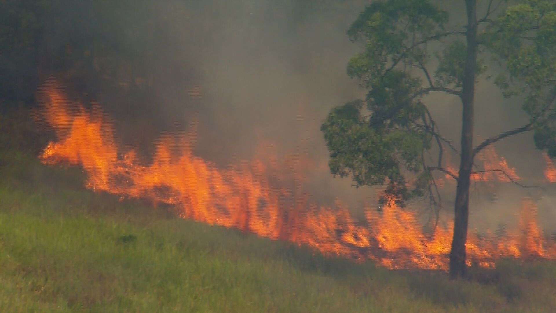
The Queensland community of Tara is being evacuated as a raging bushfire threatens the town.
Police have asked residents to follow the instructions of authorities and evacuate after an emergency declaration was declared under the public safety preservation act.
The area affected includes Chinchilla Tara Road, Terese Road, Weitzels Road and South Road.
READ MORE: Australian woman third victim of earthquake, amid tributes to dad
Residents can keep up to date with the latest warnings on the Queensland Fire and Emergency Services website.
"Initial investigations indicate the fire started in a fuel drum near a house on Charles Street," Queensland Police said.
Paramedics remain on standby after one person was taken to Tara Hospital with smoke inhalation.
Queensland Fire and Emergency (QFES) warned residents in the nearby community of Montrose to leave immediately due to the evolving situation.
Several fires have erupted as the state swelters through its hottest day in more than a year just days after bracing for heavy rain and flooding as a result of Tropical Cyclone Gabrielle.
Residents in Wolvi near Gympie have been told to prepare to leave as a fire burns through the area.
Fires are also burning in Springside, Kobble Creek and Wieambilla with residents urged to watch and act.
Sign up here to receive our daily newsletters and breaking news alerts, sent straight to your inbox.
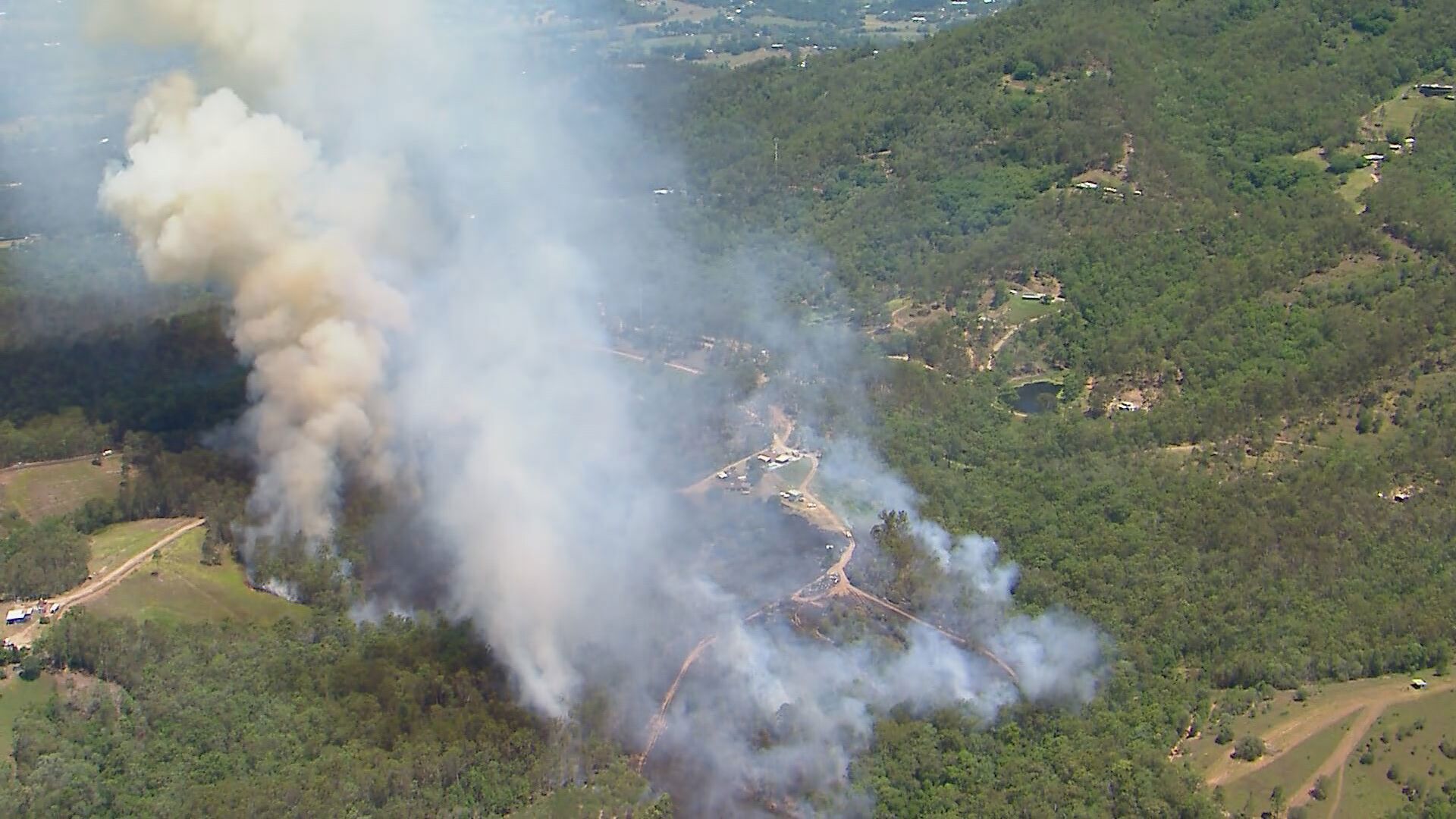
There is currently no threat to properties in Springside, Kobble Creek and Wieambilla but QFES said the situation could change quickly.
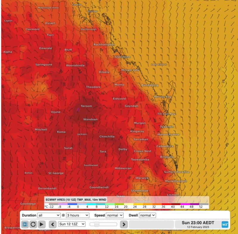
The Bureau of Meteorology (BoM) earlier issued an extreme fire danger warning for Darling Downs and Granite Belt in the state's southeast.
The bureau said the fire risk is being driven by the heatwave, low humidity and a southwesterly wind.
Fire warnings will remain for several days in the region and could lead to "uncontrollable" blazes.
It comes as a searing heatwave bore down on the state as the mercury soared 10C above average.
"Hot to very hot conditions combined with fresh west to southwesterly winds will lead to elevated fire dangers over southeast Queensland today," the bureau said.
A heatwave warning was issued earlier for the Central Coast and Whitsundays, Capricornia, Central Highlands and Coalfields and Wide Bay and Burnett Districts.
Western suburbs around Amberley and Ipswich have exceeded 39C for the first time since December 2020.
Nearby areas of the Wide Bay and Burnett and Capricornia coast have reached near 40C.
READ MORE: China warns Australia of 'abusing state power' after cameras removed
There are still severe storm warnings in place for the far north of Queensland in the Cape York Peninsula as an active monsoon is plaguing the area, the bureau said.
Heavy rainfall may lead to flash flooding in the region.
A hazardous surf warning is in place for Fraser Island, Sunshine Coast and the Gold Coast.
"Conditions are hazardous for coastal activities such as rock fishing, boating, and swimming," the BoM warned.
Cyclone risk eases, but heavy swells remain
The extreme heat is expected to ease tomorrow as the tropical cyclone moves away and a cooler onshore wind change arrives, triggering widespread showers and storms on Tuesday.
"Good news in south eastern Queensland, today will be the hottest day.
the winds will turn easterly tomorrow and bring some relief," the bureau said.
"Down around the low 30s in Brisbane, maybe 34C in Ipswich.
"For areas further north, they will see another hot day on Monday with similar temperatures to what they saw today and will cool down around Tuesday."
But temperatures are expected to remain in the 30s for another week in southeast Queensland.
All severe weather warnings for Norfolk Island have now been cancelled, however damaging surf is expected to continue.
READ MORE: Six cyclists injured in major 15 bike pile up in Sydney's north
https://twitter.com/BOM_Qld/status/1624488791095521280
Tropical Cyclone Gabrielle has left some destruction on Norfolk Island with residents reporting that trees and power lines down.
But the threat of the cyclone is now moving towards northern New Zealand bringing winds of up to 100 km/h and heavy rain.
READ MORE: Family-of-six saved from the rubble after 102 hours
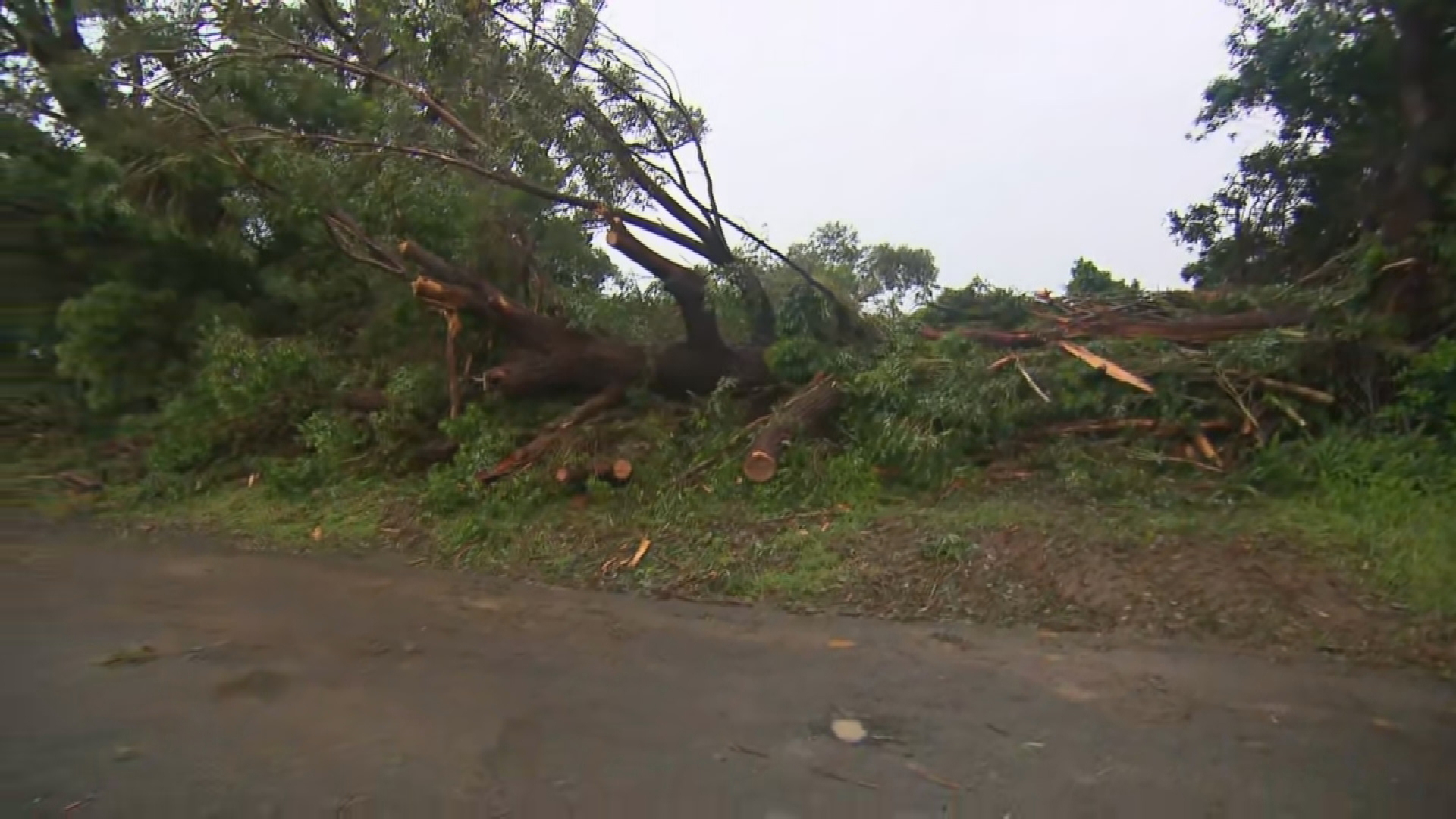
Overnight, 105km winds smashed into the island, prompting warnings from the Bureau.
However, the ex-tropical cyclone has transitioned into a vigorous sub-tropical low pressure system as it continues to move further away from Norfolk Island.
Winds have eased and gales with damaging wind gusts are no longer expected, however high waves are likely continuing around parts of the island.