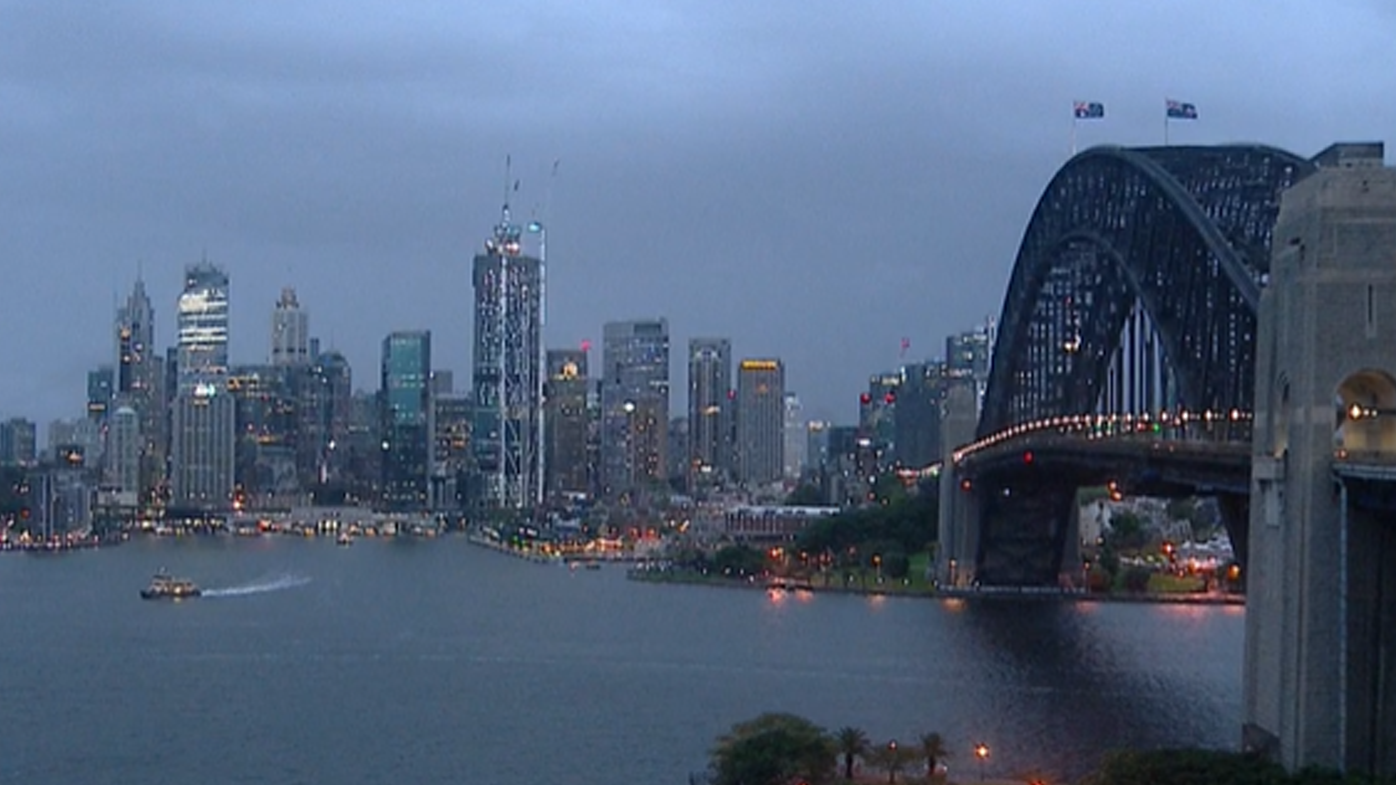
Millions of Australians on the east coast should brace for a "vigorous" weather system from tonight, which is forecast to bring several days of heavy rain, damaging surf and strong wind.
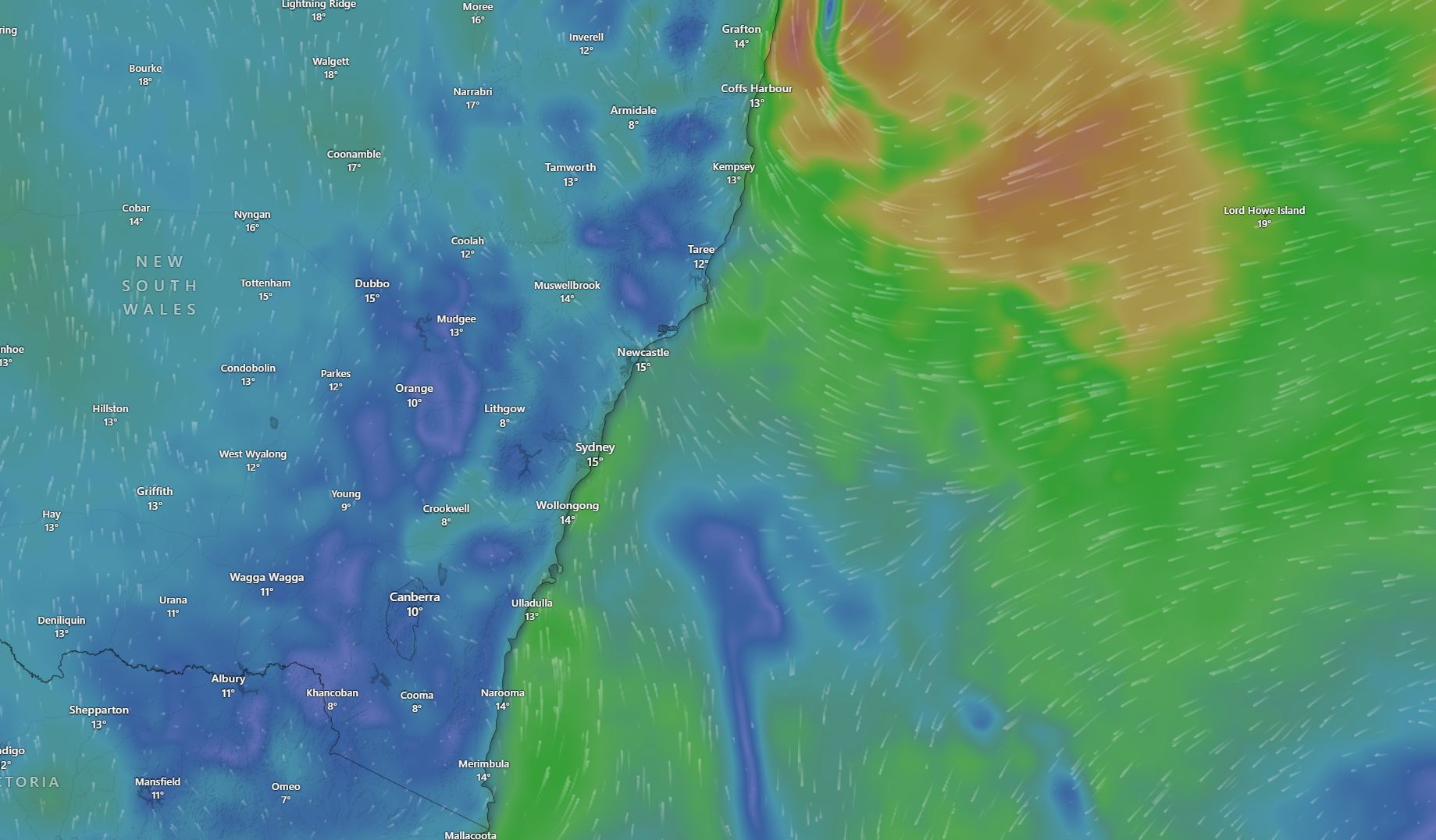
The coast of New South Wales from Coffs Harbour all the way to Bega in the south is expected to be hit with a fast-moving coastal low and the Bureau of Meteorology warned it may also hammer the Sydney metropolitan area.
"This is a very dynamic and fast-moving system, very different to the systems that we have seen in recent times," NSW SES Deputy Commissioner Debbie Platz warned.
READ MORE: Pay boost for millions of Australians arrives tomorrow
Heavy rain and damaging winds are expected to ramp up by tonight, with the most intense weather set to smash the coast by Tuesday afternoon and into Wednesday morning.
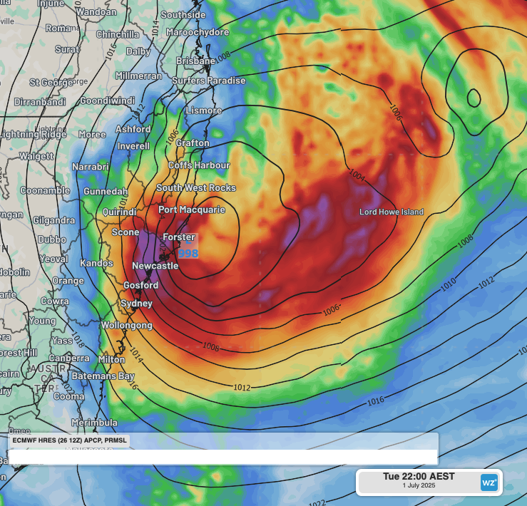
Bureau of Meteorology's Steve Bernasconi said the low is deepening off the north coast right now and will likely evolve this evening.
Around 50 to 120mm of rainfall could drench the east, south and mid-north coast of NSW, including Sydney, and some isolated showers could reach up to 200mm.
"It'll bring widespread impacts. The position and the strength of the low will determine the duration and the severity of the impacts, which may persist into Thursday," Bernasconi said.
He said it has become a "vigorous coastal low" and is complex and dynamic, meaning it is difficult to forecast just how severe the weather will be.
The NSW SES urged impacted residents to prepare for cyclonic conditions.
"We are prepared here, at SES," Platz said.
"But what we need is for you to be prepared. You out there in the community need to start preparing for this weather event."
Platz warned people to clean gutters, to move or tie down loose items like outdoor furniture and trampolines and to move cars away from large trees.
The Bureau of Meteorology has issued hazardous wind and surf warnings for the NSW coast.
READ MORE: Man charged with murder over Gold Coast death
An initial flood watch warning is also in place for the Hawkesbury-Nepean, Georges, Cooks, Sydney Coast, and Illawarra Coast catchments.
The developing system has been dubbed a potential "bomb cyclone" – a rapidly forming system that goes from non-existence to threatening in just days.
It could also be the first east coast low to hit Sydney since 2022.
READ MORE: Murder charge after remains found metres from 'missing' posters
READ MORE: Footage emerges, allegedly of reality star accused of murder
While some rain and wind is expected today, the heaviest weather is expected to hit tomorrow, particularly in Sydney.
Up to 90mm of rain is forecast for the NSW capital in just 24 hours.
Sustained winds of 45km/h, with gusts of 125km/h, are predicted by the Bureau.
Stay up to date with warnings and conditions at the BoM and SES websites.
DOWNLOAD THE 9NEWS APP: Stay across all the latest in breaking news, sport, politics and the weather via our news app and get notifications sent straight to your smartphone. Available on the Apple App Store and Google Play.