A rare tornado has been spotted in NSW's South Western Slopes region ahead of a severe thunderstorm.
A cold front attached to a low-pressure system is moving east through central parts of the state this afternoon, and is forecast to produce severe thunderstorms into the evening.
A Rural Fire Service lookout observed a tornado spiralling in Tubbul near Young about 3.30pm.
READ MORE: Apple unveils thinnest iPhone ever as new changes revealed
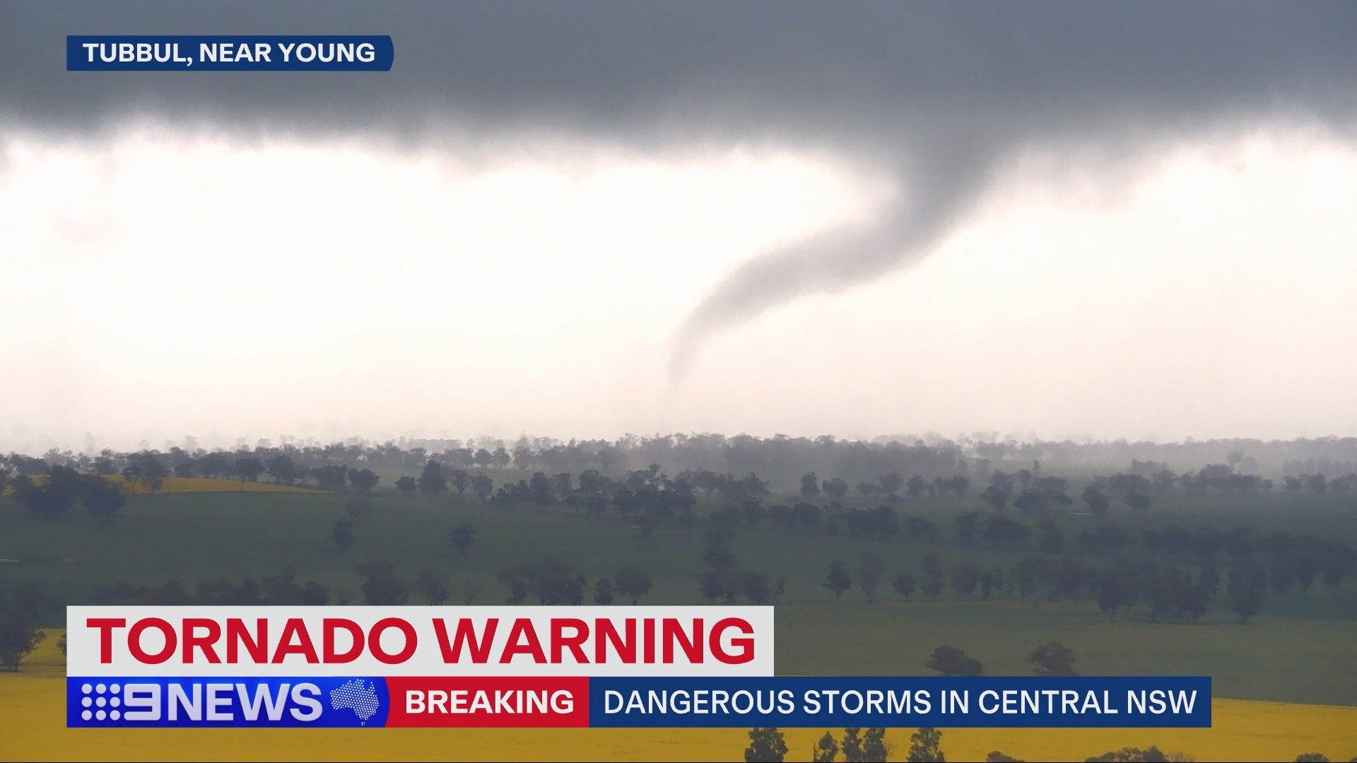
The Bureau of Meteorology issued an immediate warning, urging nearby residents to stay indoors, away from windows, be vigilant and monitor conditions.
The tornado warning has since been cancelled.
According to the bureau, tornadoes are relatively rare events, but can happen with almost any severe thunderstorm.
There are typically 10 to 20 tornado sightings across Australia each year.
Flash flooding warning
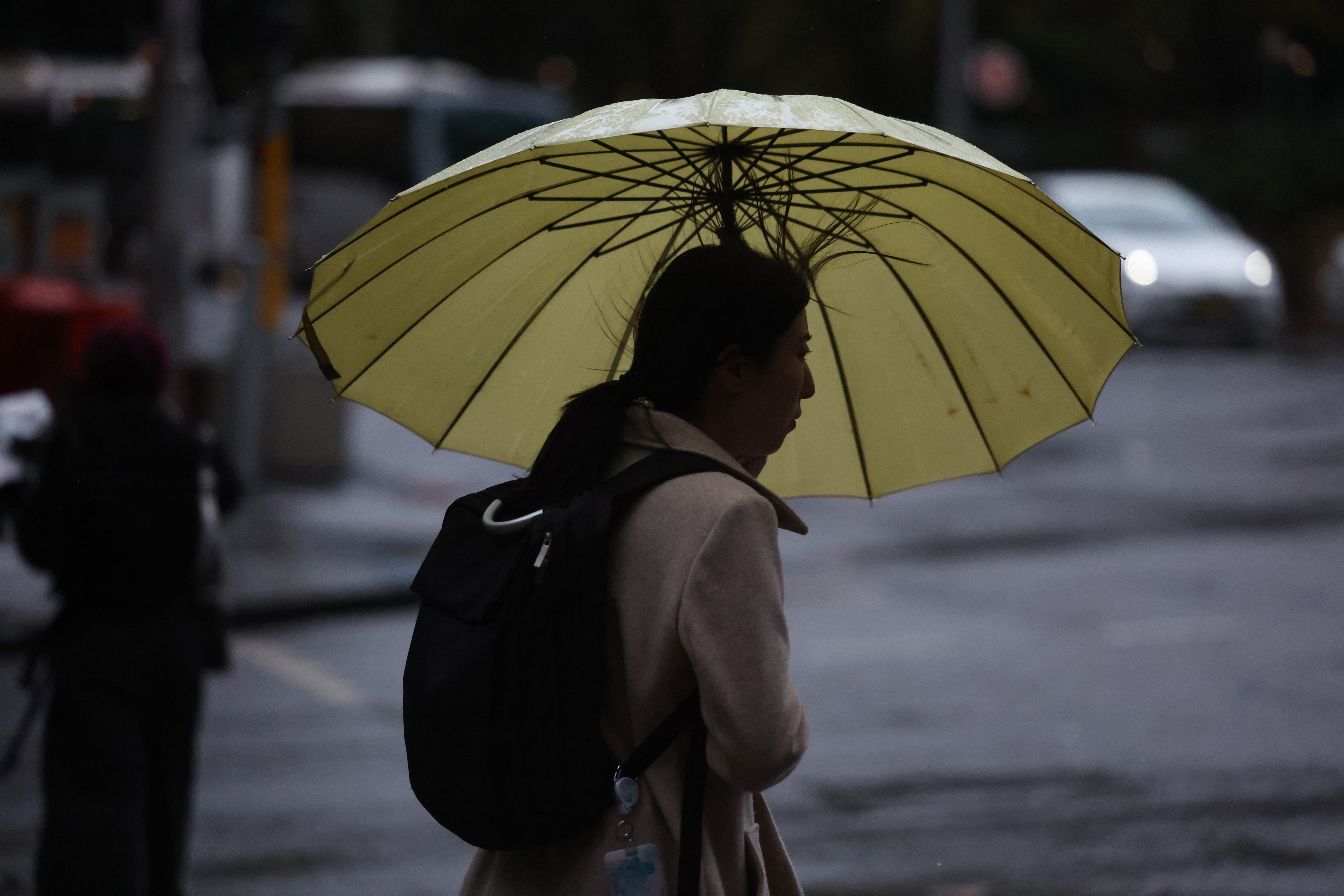
A severe weather warning is in place for Hunter, Central Tablelands, Southern Tablelands, Central West Slopes and Plains and South West Slopes regions, with residents on alert to expect damaging winds, large hailstones and heavy rainfall.
Flash flooding is possible in Orange, Bathurst, Yass, Young, Morisset and Oberon in the next several hours.
There are currently nine weather and flood advice warnings in place across the state.
Residents in parts of the Mid North Coast and Northern Tablelands and on Lord Howe Island are urged to prepare now for the system.
READ MORE: 'Wrong thing to do': Australia condemns Israeli attack on key mediator Qatar
The weather system has the potential to bring six-hourly rainfall totals between 60 to 100mm of rain from this evening for parts of the southern Illawarra, northern South Coast and eastern Southern Tablelands.
Parts of the coast could see 24-hour totals up to 140mm.
The bureau also posted on X to say thunderstorms could be "extensive".
"Storms could become severe, with heavy rainfall, damaging wind and large hailstones all possible outcomes," BoM's post said.
"Thunderstorm Warnings will be issued if this happens. It's a good day to stay up to date."
Sydney is forecast to see 15mm to 45mm of rain today, with falls tailing off toward the evening.
Bureau of Meteorology senior meteorologist Miriam Bradbury said residents on the coast were likely to see damaging wind gusts and waves as the weather system hovered over the coast.
"It will linger there and draw in moisture and strong winds, directing them against the coast and potentially leading to further severe weather for areas between the Hunter and the South Coast," she said
READ MORE: What's next for children on the run for years with slain fugitive?
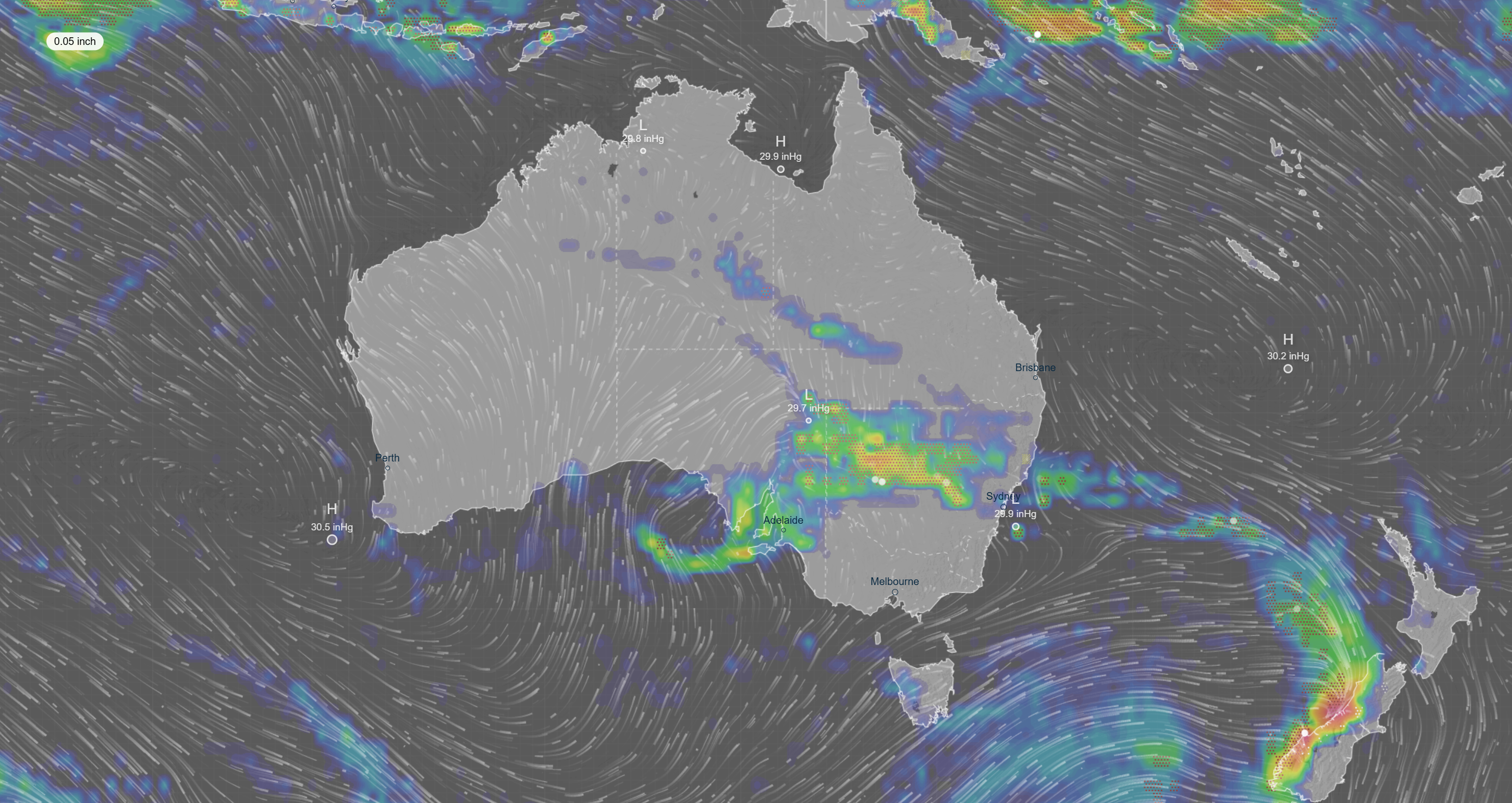
Over the next two days, the wet weather will also increase for northern Victoria and southern Queensland as the rainband and low-pressure system start to bind and produce widespread rain and thunderstorms.
"We will see moderate rainfall totals for some of these areas, especially for much of eastern and south-eastern NSW but also north-eastern Victoria and severe thunderstorms are possible again with the risk of damaging winds and heavy rain," senior meteorologist Jonathan How said.
"On Wednesday, Sydney and Canberra will see a wet, cold and rainy day while Melbourne and Adelaide will also see showers."
DOWNLOAD THE 9NEWS APP: Stay across all the latest in breaking news, sport, politics and the weather via our news app and get notifications sent straight to your smartphone. Available on the Apple App Store and Google Play.