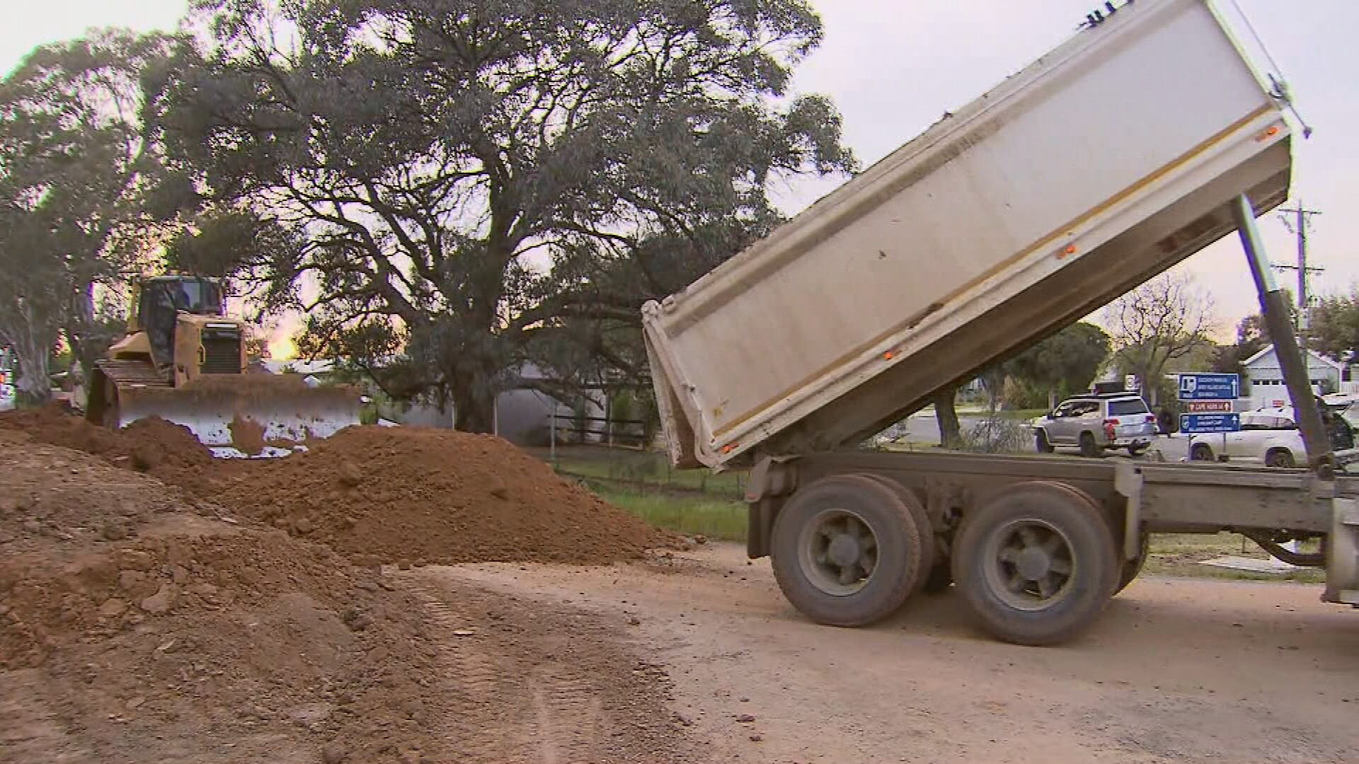
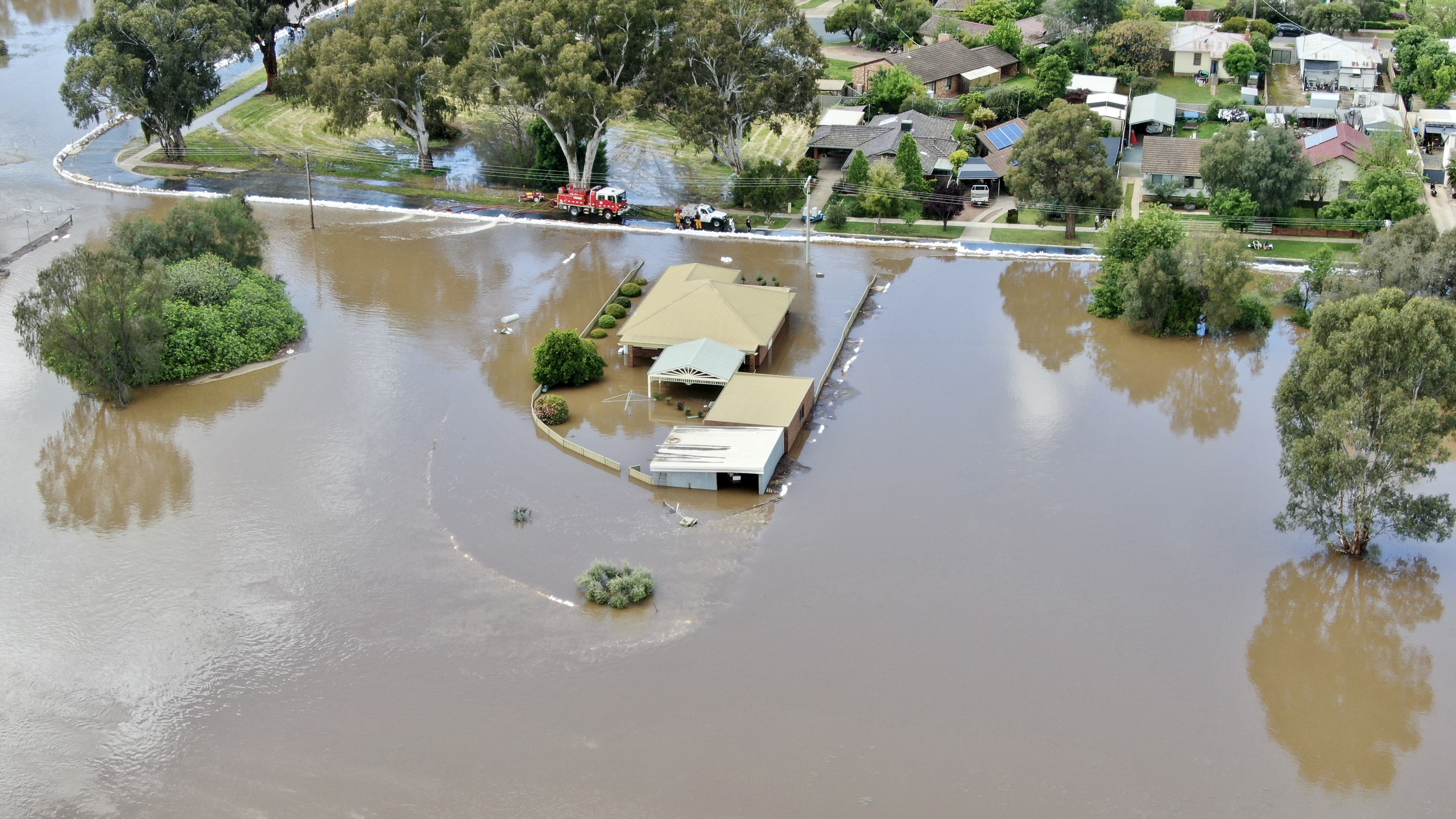
The Echuca community is continuing to rally together to build a levy to protect thousands of homes from flooding when the Murray River peaks later this week.
Labelled the "great wall of Echuca" by locals, the levee, made from tonnes of soil, stretches nearly three kilometres long and two metres high.
The Bureau of Meteorology expects the Murray River to exceed the major flood level of 94.4m AHD (Australian Height Datum) on Thursday and may hit 95m AHD on Friday.
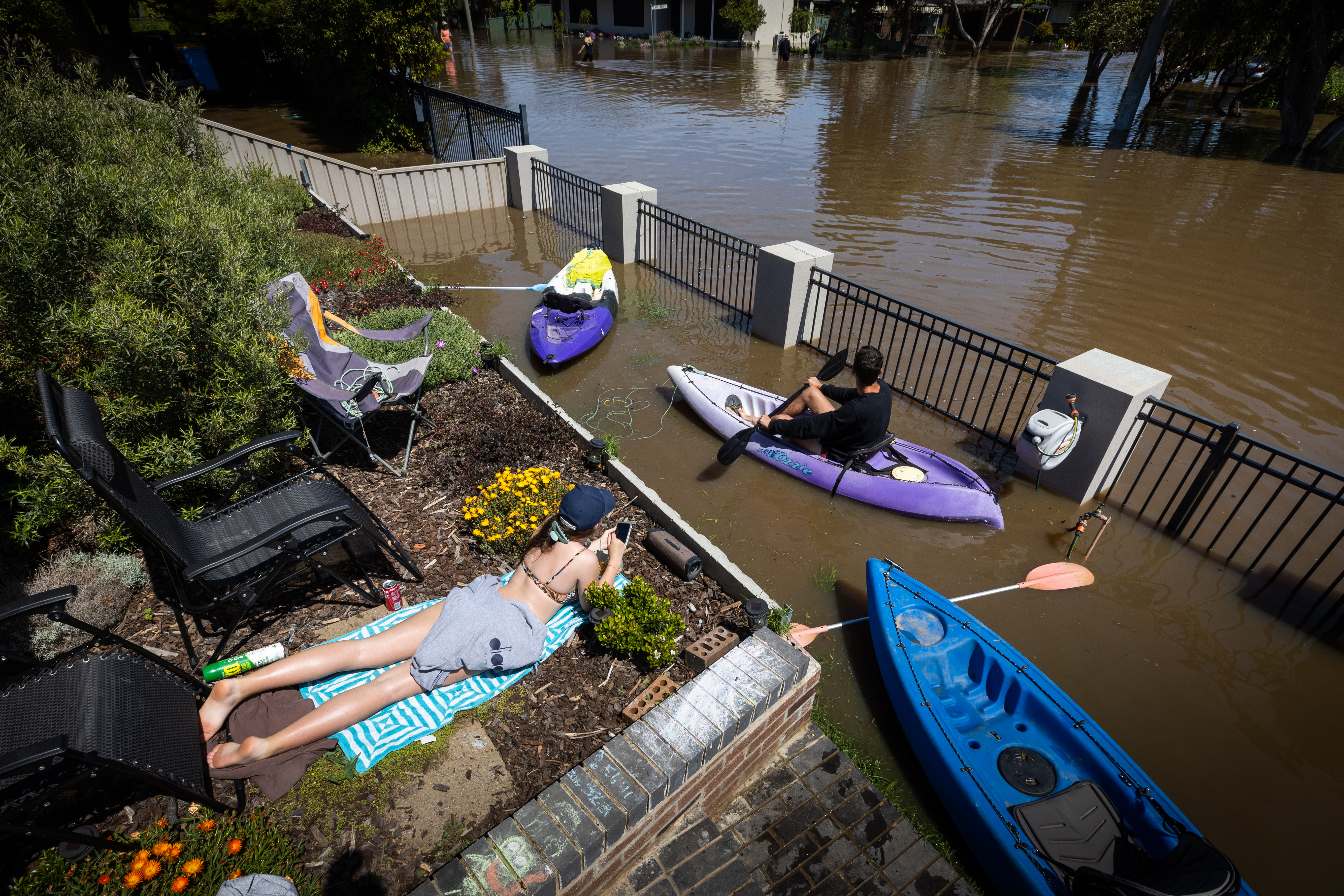
About 34,000 homes remain at risk across the state as thousands of homes are inundated or isolated in Shepparton.
READ MORE: 'Rain, and lots of it' coming as multiple weather events pass over nation
Warnings in place
There are about 60 warnings still in place across the state, 13 of those are emergency warnings with residents told to evacuate immediately in Echuca and Charlton.
Floodwaters in the town peaked yesterday, 15 centimetres shy of the 12.2 metres predicted however evacuation orders are still in place for the town.
Residents can find the latest warnings and evacuation orders on the VicEmergency website and weather updates on the Bureau of Meteorology website.
A fresh Emergency Warning for residents living in Rochester to move to higher ground was issued at midday.
Similar orders are in place for Bunbartha, Kerang, Loddon, Zeerust, Mundoona, Kaarimba, Coomboona, Mooroopna North, Tallygaroopna, Undera, Charlton and Echuca, as of Tuesday at 9.30am
READ MORE: Warning issued as venomous snakes spotted swimming through floodwater
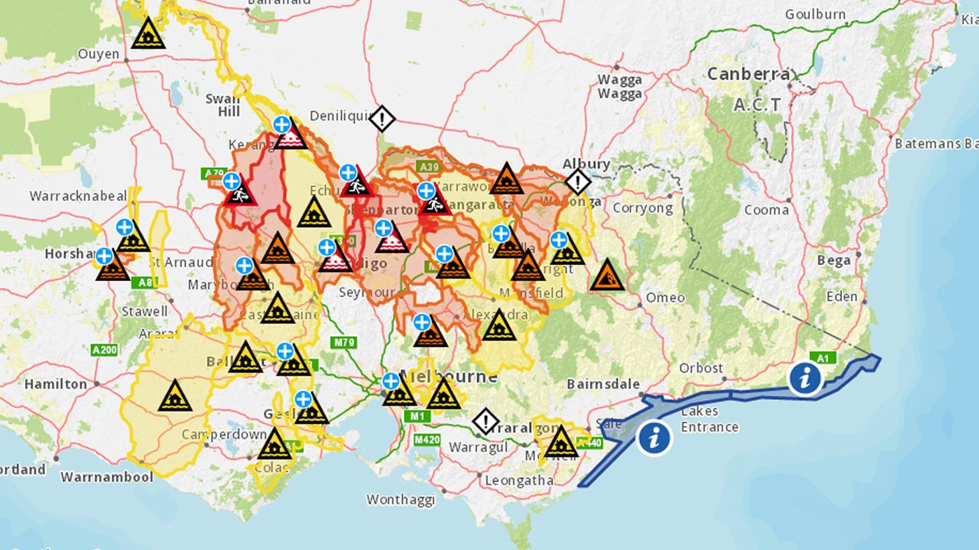
From Loddon Weir to Kerang, people are being advised they may be isolated for at least a week if they do not evacuate the area.
"Boort is predicted to be isolated for up to one week, similar to the 2011 floods," Vic Emergency has said.
"Two more peaks are expected for Appin South. Water is anticipated to be higher than expected at Kerang, but remain below the levee. If you do not wish to be isolated for at least a week within the levee area, it is recommended you relocate as soon as possible.
"If you choose to stay you will need to be self sufficient for the period of isolation.
"Leaving now is the safest option, before conditions become too dangerous."
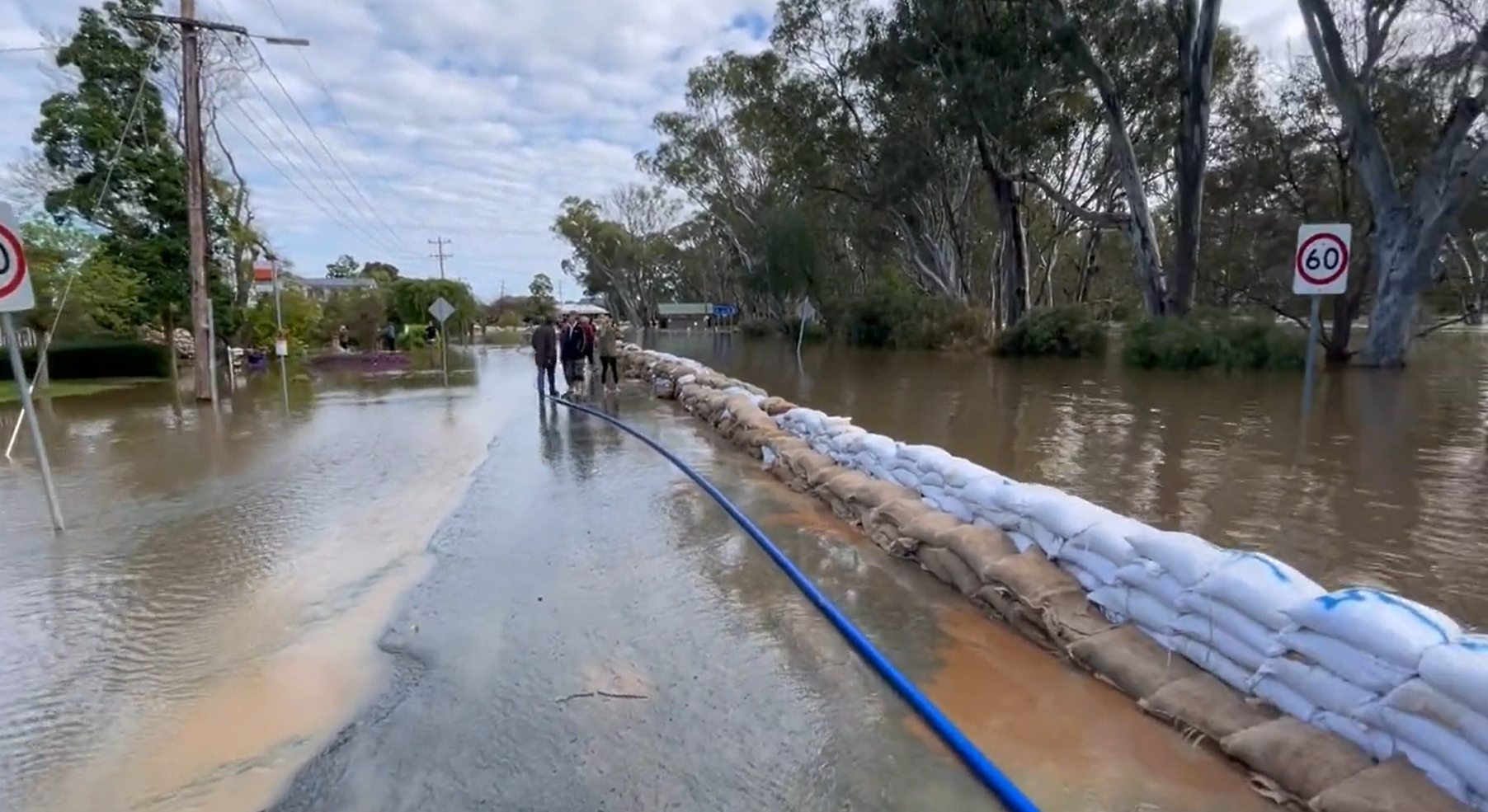
Evacuation orders have also returned in the small town of Rochester, of which 85 per cent was flooded on Friday.
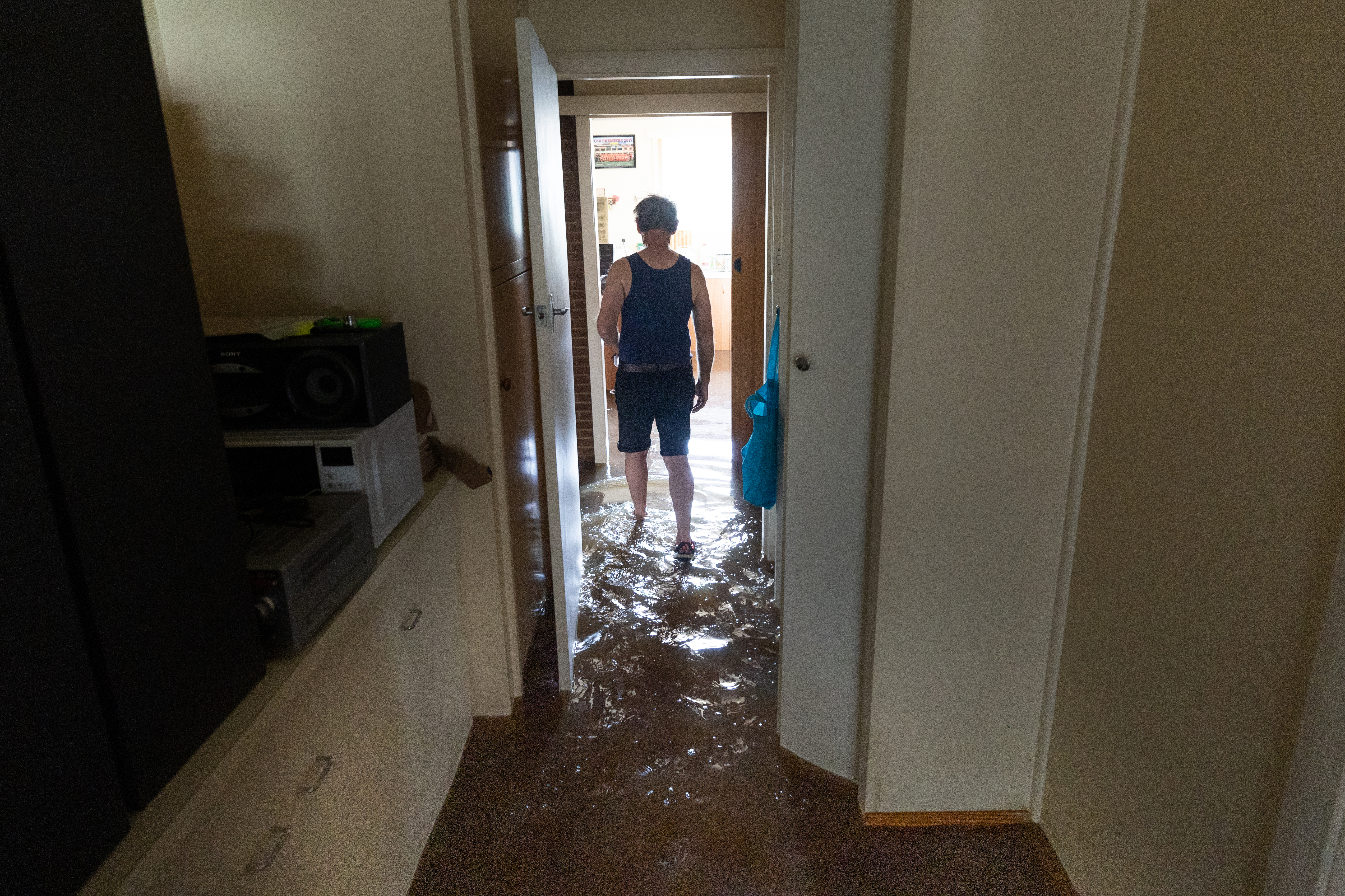
Since the event started, there have been more than 700 flood rescues and more than 7000 requests for assistance.
READ MORE: 'Frightened, wet and exhausted' native animals filmed desperately fleeing floodwaters
https://twitter.com/vicsesnews/status/1582179747773444096
Rochester residents are also being warned the town's sewerage system has been damaged by the flooding, and may take up to eight weeks to be fixed.
Over the past 24 hours the state's SES have conducted 130 flood rescues, with predictions some rivers, such as the Goulburn, will stay at major floods levels until Friday at least.
Today 250 beds at the Mickleham quarantine facility will be opened to house evacuated residents across Victoria.
The site has capacity to expand to 500 beds.
Victorian Premier Daniel Andrews said "only a handful" of flood victims were at the Mickleham quarantine facility in Melbourne's north.
"There are four people there already," Andrews said.
"We have had a number of other people who have expressed an interest to move there.
"I think more and more, with the passage of time, people process that practical reality that they're perhaps not going to be able to get back into their house for quite some time."
READ MORE: Victorians impacted by floodwaters eligible for emergency payments
Homes deemed 'unsaveable' amid frantic rush to save Echuca
More heavy rain is expected to fall in the coming days as a low pressure system moves over the east coast.
The heaviest rain is expected to fall on Sunday.
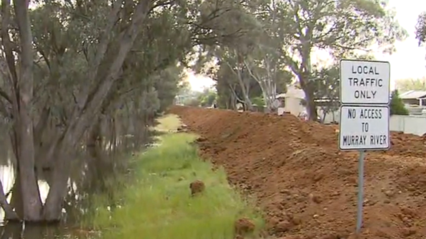
The town of Echuca is bracing for a second flood peak with the Murray River already experiencing significant flooding.
"River levels at Echuca Wharf may reach levels higher than the 1993 flood (94.77 m AHD) from Friday," the Bureau warned.
"As this flood water moves downstream, river level rises and significant major flooding is expected at Torrumbarry and Barham."
Locals have worked overnight to build a 2.5 kilometre clay levee, and walls of sandbags are lining the streets.
Despite the efforts, Today reporter Izabella Staskowski said some homes have still been deemed "unsaveable".
"They are on the other side of the levee," she explained.
"They've had to accept those homes are very likely to be inundated."
The town is surrounded by three river systems; the Murray, the Goulburn and Campaspe.
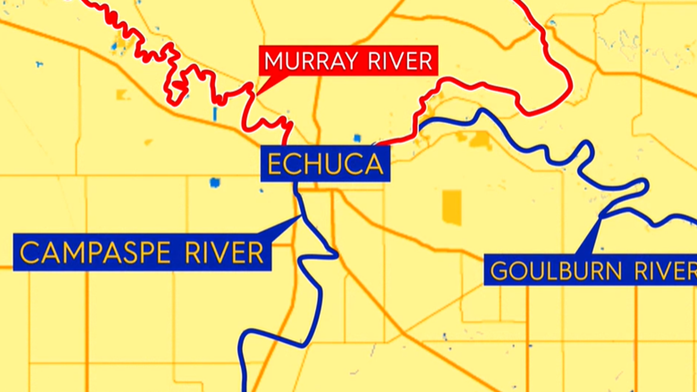
"The Campaspe and the Goulburn have already broken their banks," Staskowski said.
"The Campaspe has started to subside ever so slightly but the Murray is the incoming threat."
Kerang could be isolated for two weeks
Victoria's emergency measures commissioner Andrew Crisp has told reporters that the Kerang community could remain isolated for weeks.
"We know the community could be isolated for one to two weeks," he said.
Kerang is located on the Loddon River in northern Victoria.
Residents have been told today to decide if they are leaving or staying as meat is stripped from the shelves at the local Woolworths.
The township was cut off in the 2011 floods and it's expected to happen again.
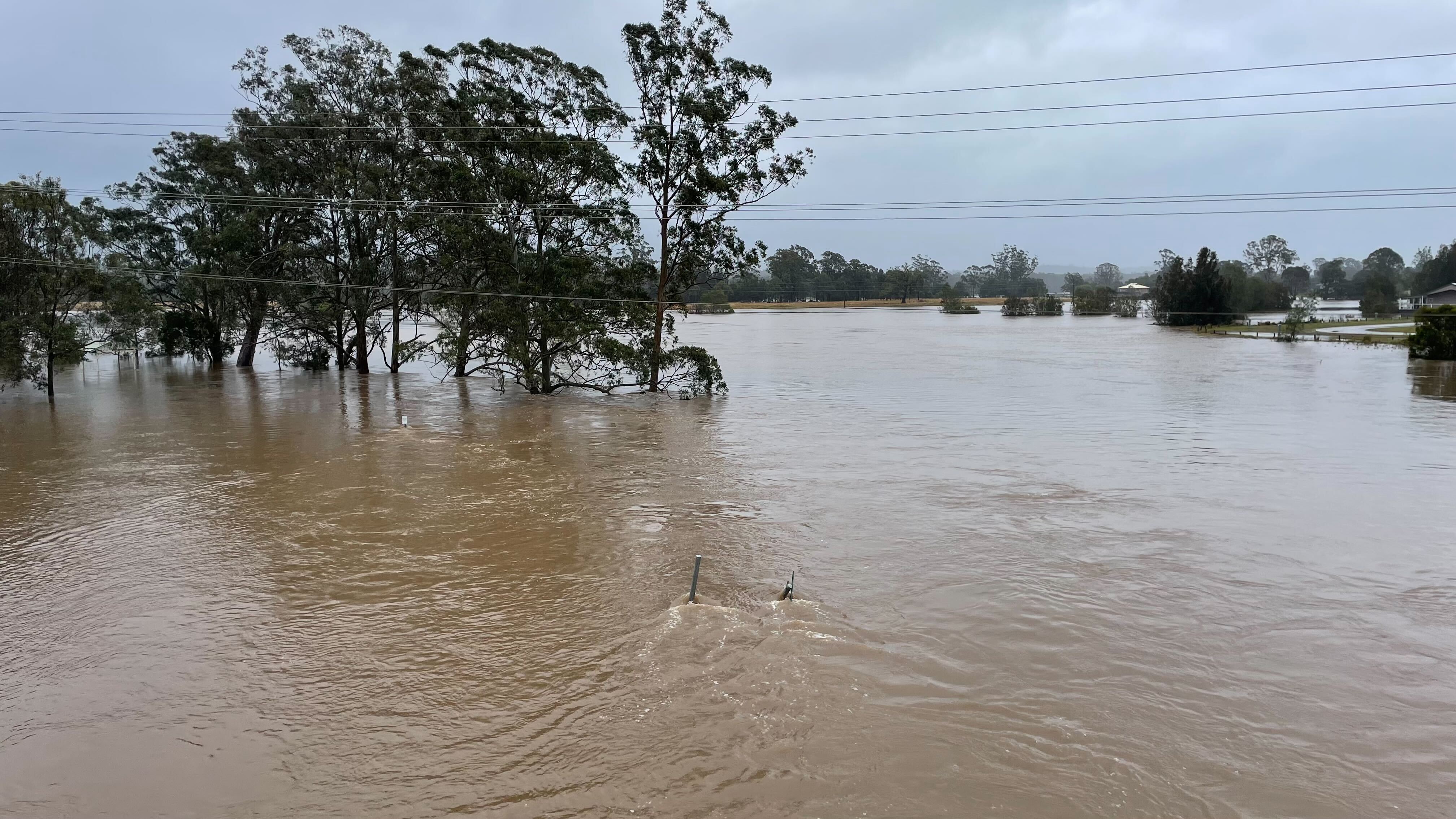
Evacuation orders remain in part of Shepparton
Shepparton is still awash with water, with people in some areas stuck due to floodwaters, and Vic Emergency advising them it is too late to leave the areas.
Some parts of Shepparton have remained untouched by the floods, but many residents have lost everything.
Hundreds of people are camping out at the relief centre at Shepparton Showgrounds, which has reached capacity.
READ MORE: UK Prime Minister Liz Truss under pressure after historic tax cut U-turn
Andrews has announced a $351 million flood recovery package to help the state's recovery.
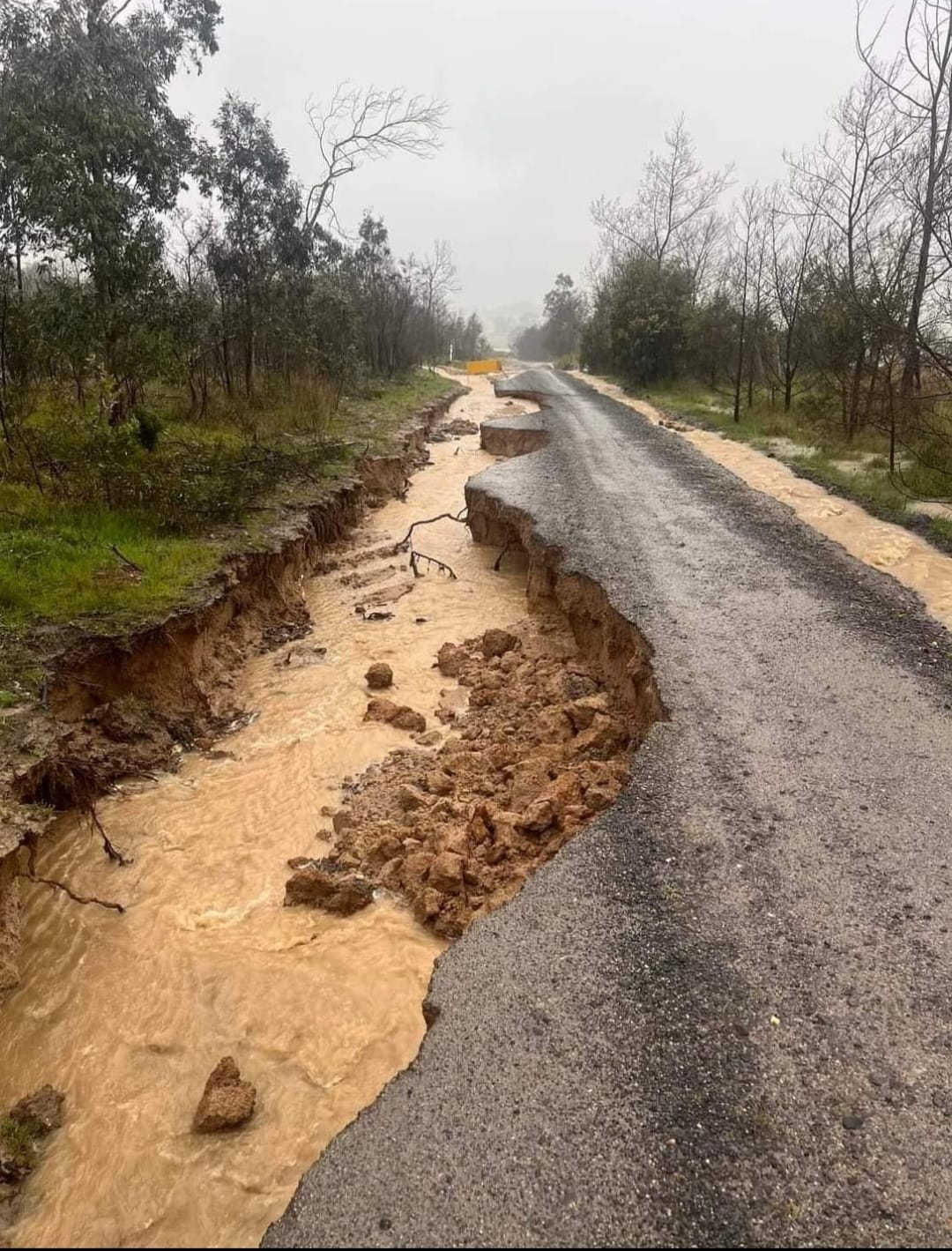
Of this, $165 million will be dedicated to road repairs, as hundreds of roads have had concrete torn from the ground by raging flood water.
Andrews yesterday said 359 roads were closed across the state due to damage or flooding, while crews had already 10,000 potholes and attended to 20 landslides since the flooding began late last week.
"Getting hundreds of roads fixed and reopened is going to be a massive job – so we're calling in reinforcements," he said.
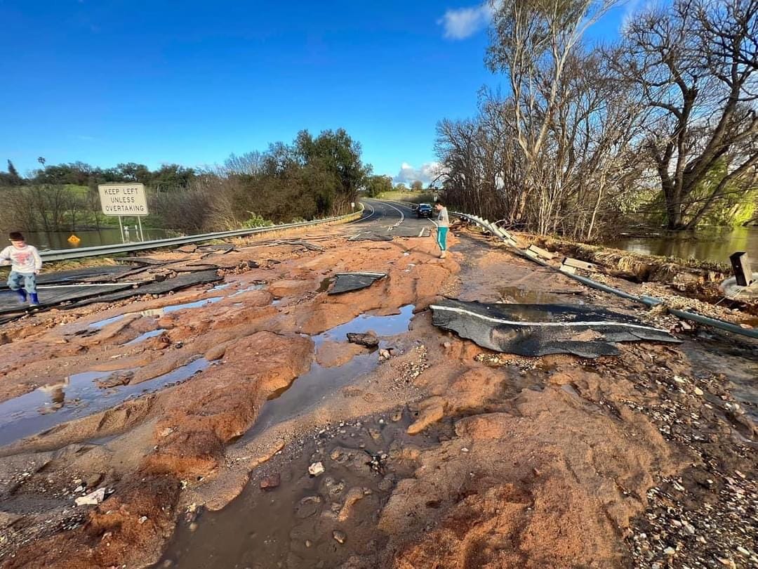
"As part of a massive emergency road repair blitz, workers from our Big Build projects will be heading out across the state.
"They'll find and fix potholes, and entirely rebuild roads and bridges.
"Getting these roads back open is critical for people heading home after evacuating, and getting freight moving around the state."
Floods 'likely to push up the cost of living'
Treasurer Jim Chalmers yesterday warned the floods would put further pressure on grocery prices, stretching Australian budgets.
"I think we need to brace ourselves for the impact of these natural disasters on the cost of living, we're talking here about some of the best growing and producing country in Australia," he said, adding it would have consequences for the budget, set to be handed down next Tuesday.
"These are likely to push up the cost of living when Australians are already under the pump."
The warning comes as New South Wales and Tasmania also grapple with flooding of their own.
NSW SES currently has 70 warnings across the state. Of these, seven are at emergency level.
READ MORE: The Bureau of Meteorology wants you to stop calling them by the name everyone uses
"Flooding continues in western and southern NSW, with focus currently on Murray River community Moama and communities that may be affected by further rain," it said in a statement.
"Another low-pressure system is forecast from Wednesday this week and another one on the weekend.
"Given current flooding, saturated catchments, this weather will exacerbate current flooding, and multiple rivers are anticipated to see renewed minor to major flooding.
"Further rainfall is likely to continue until December."
The ADF has been called in to help flood victims in NSW,.
A total of 180 personnel will be sent into at-risk communities, particularly in the western regions of NSW.
The main focus for firefighters is on the Moama region, where the RFS has set up two base camps that will accommodate 550 people.
While the flood threat is subsiding in Tasmania, the BoM has issued several flood warnings .
Residents can stay across updates here.