The person remains missing despite initial search efforts by the crew.
Tag Archives: oceania
Witnesses describe moment decorated soldier was arrested at busy airport
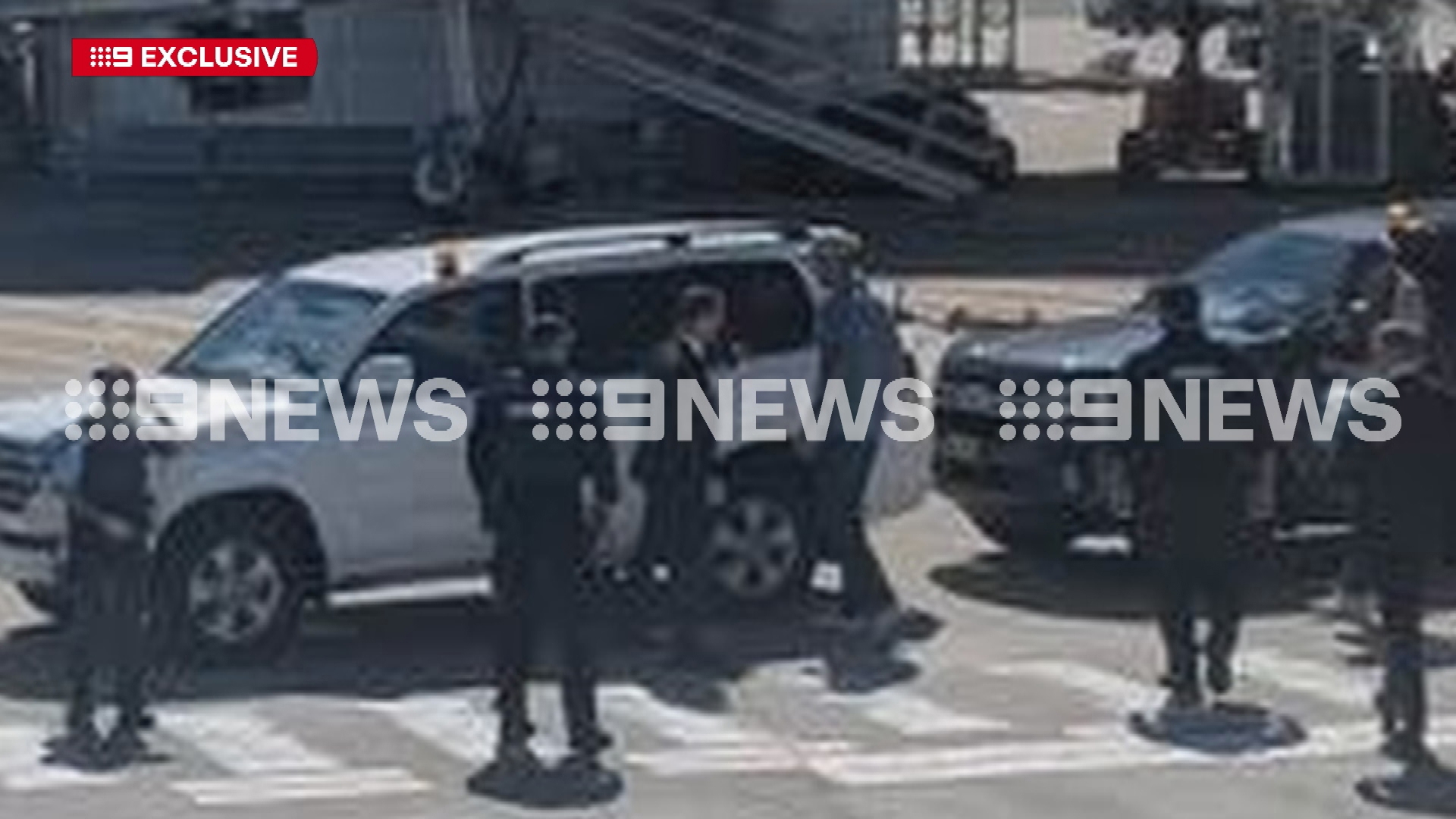
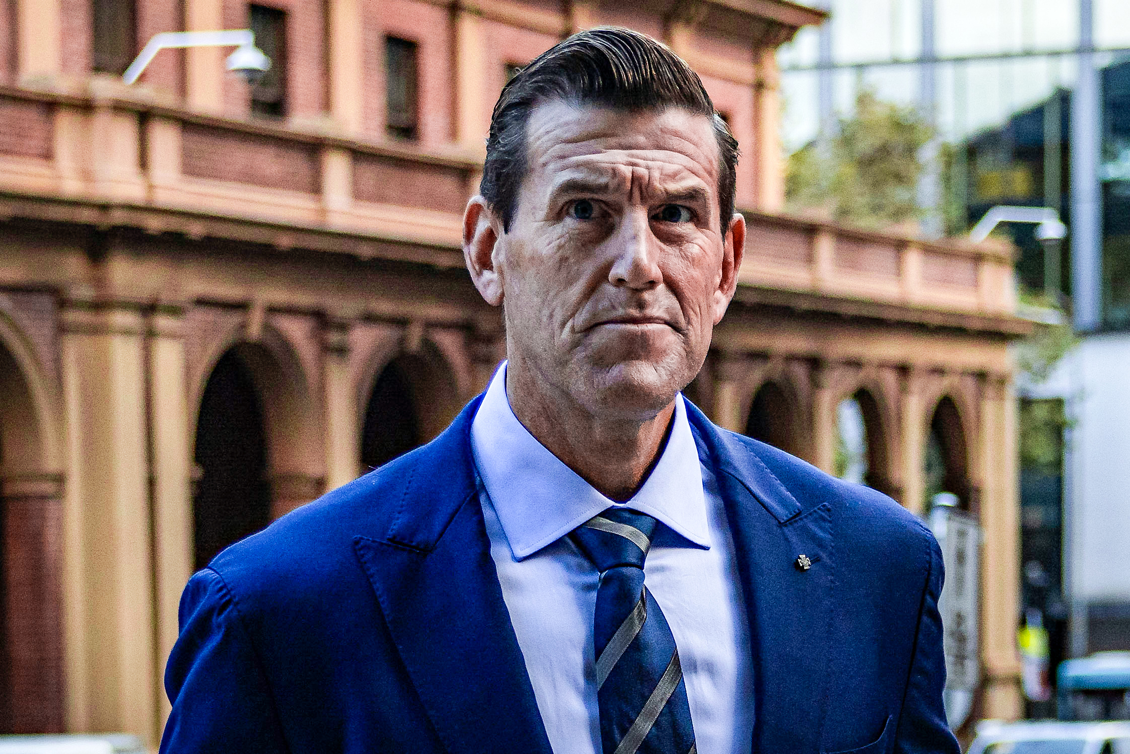
Witnesses have described the moment former ADF soldier Ben Roberts-Smith was taken into custody on the tarmac at Sydney Airport this morning.
Federal detectives were filmed walking through the domestic terminal, just moments before the former SAS soldier was arrested after getting off a flight from Brisbane.
Witnesses described the moment Roberts-Smith was taken into custody.
READ MORE: Ben Roberts-Smith arrested as part of war crimes investigation
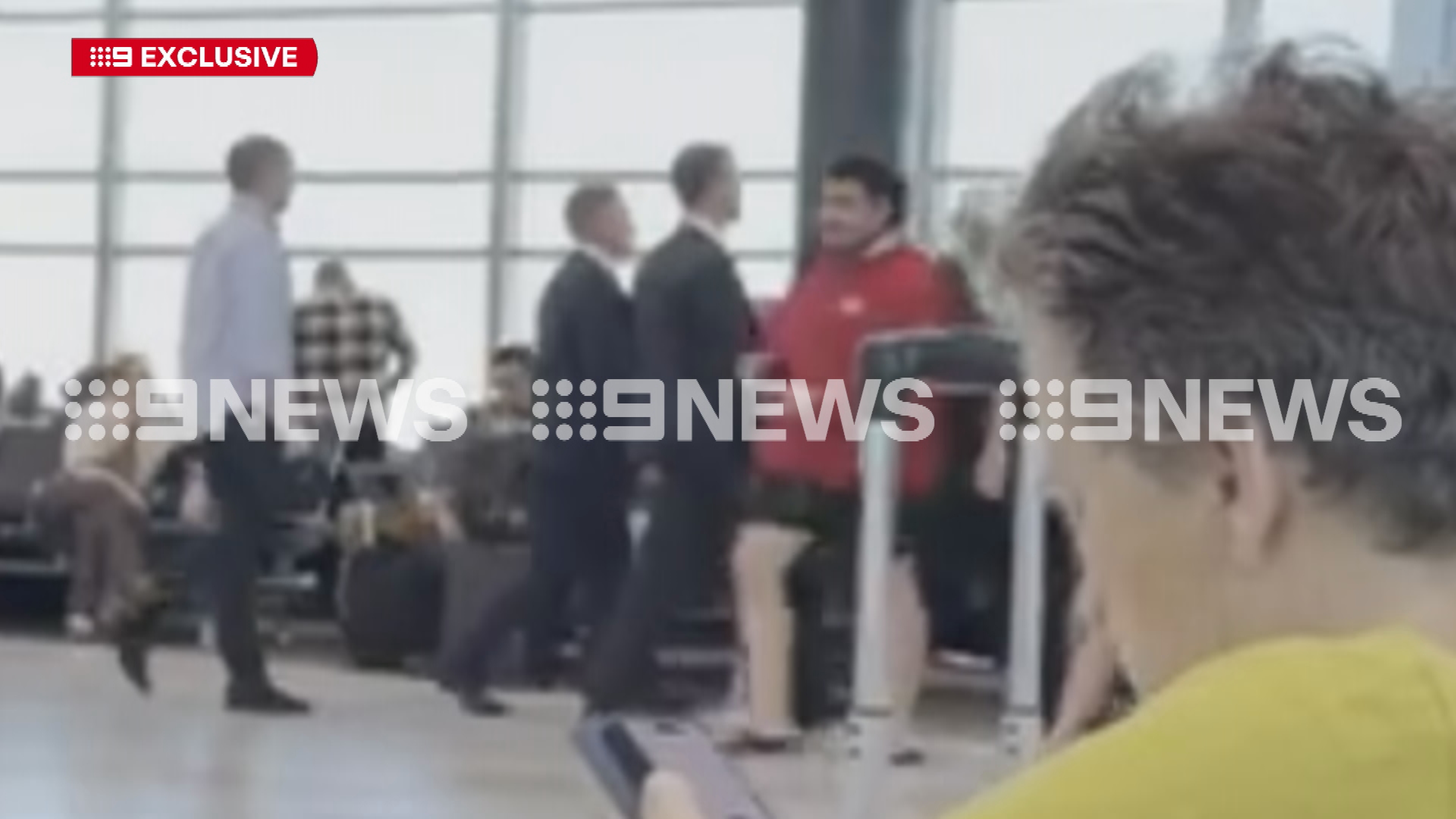
"Our plane stopped and then we looked outside and there was two AFP cars and then after that we saw a man get taken into one of the cars and his family followed behind," a passenger said.
"I just saw federal police pull over, taking whatever-his-name-is into the vehicle," another witness said.
"It is a bit of a shock to see the commotion."
READ MORE: How a five-year investigation led to Ben Roberts-Smith's arrest at Sydney Airport
Roberts-Smith has always denied any allegations of wrongdoing.
The Victoria Cross recipient was charged this afternoon with five counts of war crime – murder:
- The war crime of murder, in that he intentionally caused the death of a person, on or about 12 April, 2009, at Kakarak, Uruzgan Province, Afghanistan.
- The war crime of murder, in that he aided, abetted, counselled or procured another person to intentionally cause the death of a person, on or about 12 April, 2009, at Kakarak, Uruzgan Province, Afghanistan.
- The war crime of murder, in that he aided, abetted, counselled or procured another person to intentionally cause the death of a person, on or about 11 September, 2012, at Darwan, Uruzgan Province, Afghanistan.
- The war crime of murder, with another person, in that they intentionally caused the death of a person, on or about 20 October, 2012, in Syahchow, Uruzgan Province, Afghanistan.
- The war crime of murder, in that he aided, abetted, counselled or procured another person to intentionally cause the death of a person, on or about 20 October, 2012, at Syahchow, Uruzgan Province, Afghanistan.
The maximum penalty for the offence of war crime – murder is life imprisonment if found guilty
It is the second time the Office of the Special Investigator and AFP has laid war crime murder charges against an ADF member in Australia.
NEVER MISS A STORY: Get your breaking news and exclusive stories first by following us across all platforms.
- Download the 9NEWS App here via Apple and Google Play
- Make 9News your preferred source on Google by ticking this box here
- Sign up to our breaking newsletter here
E coli discovery causes well-known Auckland cafe to take the day off
About 7500 homes and businesses were told to boil all tap water.
‘It’s going to be 1975 again’: Diesel prices face sharp jump
AA’s Terry Collins says refining costs have surged about 600%.
University of Canterbury student bar The Foundry introduces ticketing system after crushing event
Live DJ nights will return to The Foundry for the first time since October’s incident.
Foxton Shannon Rd crash: One dead after car hits power pole
The single-vehicle crash into a power pole was reported just before 4pm.
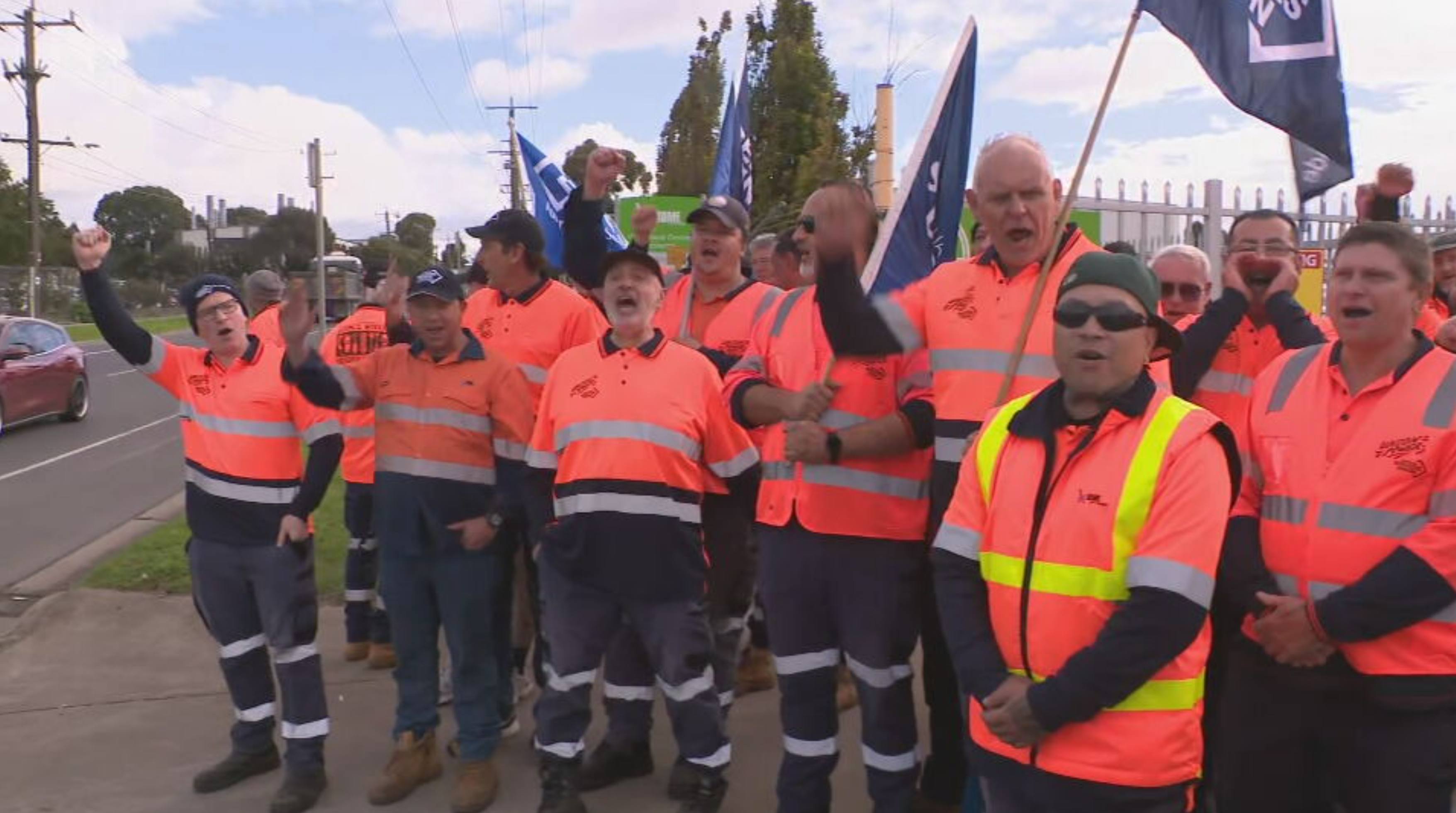
Why full bins are being left on the streets this week
Thousands of Melbourne households will be forced to cram their rubbish into full bins this week, as kerbside collectors from several councils walked off the job today over pay and conditions.
Waste collectors from Hume, Darebin and Merri-bek councils began strike action this morning, seeking a 10 per cent pay increase this year, followed by 4 per cent increases every year over the next three years.
"They have watched their wages fall by 10 per cent in real terms over the last four years," Australian Services Union (ASU) National Branch Secretary Tash Wark said.
READ MORE: Australian flight attendant dies after road accident in Fiji
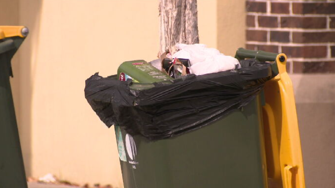
Household bins and public bins across Melbourne's north weren't emptied today, forcing residents to wait another week until they are collected.
The City of Hume was the worst hit, with around 70 workers walking off the job.
Merri-Bek and Darebin councils were able to bring in in casual staff to minimise the impact on ratepayers.
Wark said residents in Hume would "have to wait".
"We're sorry about that, but we need to make sure our members are seen and heard."
Council worker wages have fallen between seven and 12 per cent since 2021, according to the union.
"ASU members have had a gutful of being left behind while the rate capping policy has really torn down wages in local government," Wark said.
"They're striking today to seek a 10 per cent pay rise, which only goes part of the way to make up from the cost of living and inflation they've been subjected to in the last few years."
READ MORE: Former Olympic cyclist Rohan Dennis accuses media of peddling 'false narrative' after wife's death
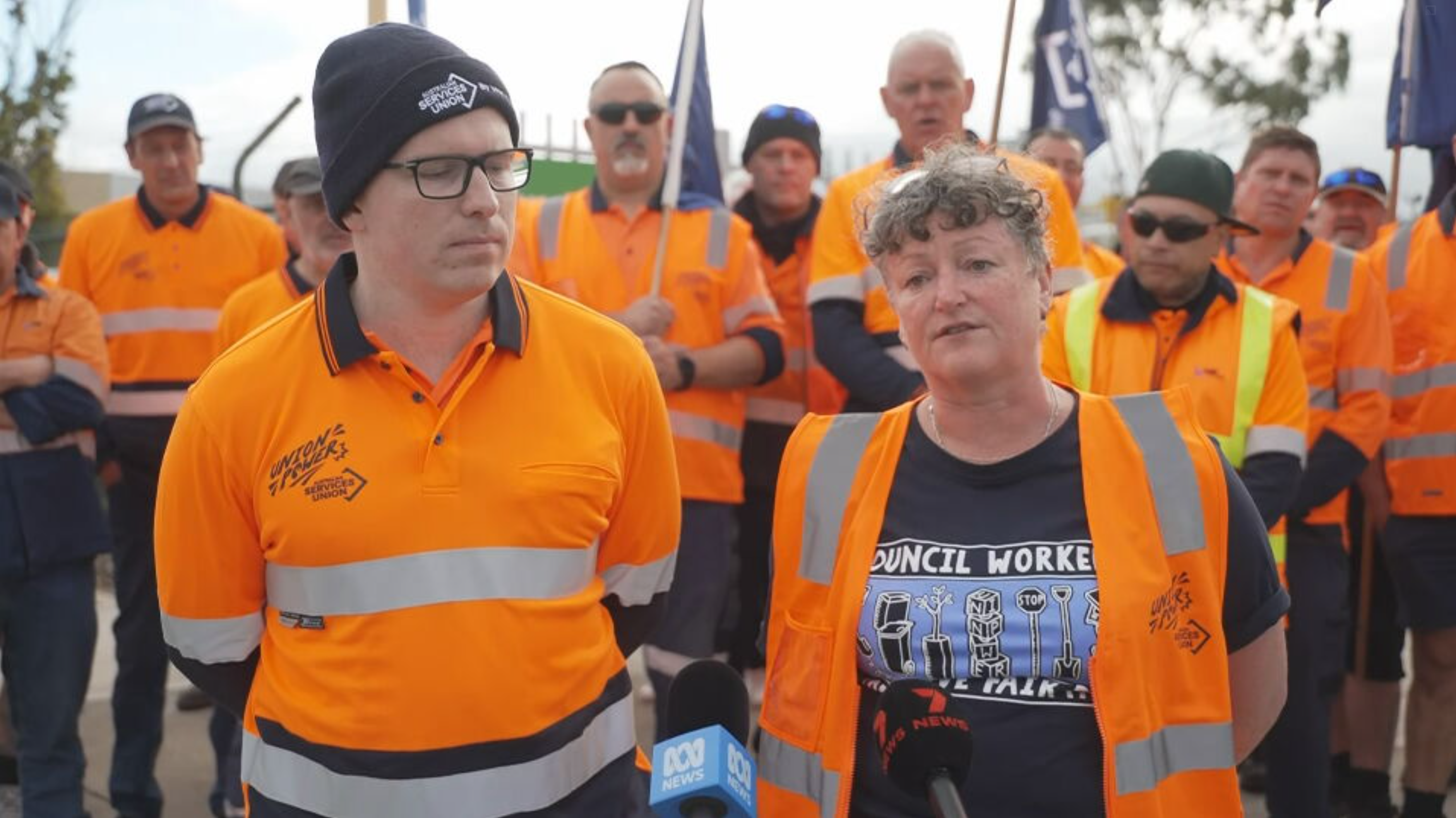
Union members claim they haven't received a pay rise in almost two years.
"Our members have been fighting for a year and a half just to get to the table," Wark said.
"Our members are doing this action regretfully, it is not their first choice, they love their jobs, they're really proud of the communities they support but this is where we're at."
Hume garbage collector Jayden Watson said the wage stagnation had put him behind in his goal of buying a home.
"I try to work hard, I try to stay behind and do more hours… [but] I'm falling behind whilst trying to save money," Watson said.
"We all need to pay bills. Some people are struggling to get food on the table."
In a joint response, the affected councils said negotiations with the ASU was ongoing.
"While we acknowledge the legal right of the ASU to take protected industrial action, these actions affect our communities, which is regrettable," the councils said.
"We are keeping our communities informed on how any industrial action may affect them.
READ MORE: Ben Roberts-Smith arrested as part of war crimes investigation
"We ask our communities for their patience and we will continue to negotiate in good faith with all unions representing our staff."
In addition to the pause on rubbish collection, parking officers in the the cities of Yarra, Maribyrnong and Melbourne also stopped work today.
Local councils claim they're restricted in what they can offer employees, due to the state government's rate-capping policy.
"Every time workers sit down to bargain with councils, they're told the rate cap means that they can't meet their demands. It's not good enough," Wark said.
"It's a simple question of priorities: if the government can find money for politicians like councillors whose wages have gone up by over 10 per cent, they can find the money for the people who pick up the rubbish," Wark said.
READ MORE: Winter blast to leave states reeling before severe storms this week
But Acting Premier Ben Carroll insisted the rate cap was a vital measure for the broader community.
"The rates cap is a really important cost-of-living measure that supports hardworking Victorians every day," he said.
A second bargaining meeting was scheduled for today.
If an agreement is not reached at that meeting, further council worker strikes are scheduled for Darebin, Greater Dandenong, Hobsons Bay, Hume, Maribyrnong, Melbourne, Merri-Bek and Yarra tomorrow.
"It will be things like parks not being mowed, library disruptions, no parking tickets being issued," Wark said.
"Anything a council worker does is going to get disrupted in the next little while.
"We will keep taking action until members get what they deserve."
NEVER MISS A STORY: Get your breaking news and exclusive stories first by following us across all platforms.
-
Download the 9NEWS App here via Apple and Google Play
-
Make 9News your preferred source on Google by ticking this box here
-
Sign up to our breaking newsletter here
Man wondered why his internet stopped working, found burglar holding his stolen Wi-Fi modem
Burgler Rangi Ferrall kicked the victim in the stomach and punched him in the face.
Pauline Hanson, Tony Abbott speak in support of Ben Roberts-Smith following arrest
One Nation leader Pauline Hanson and former Australian prime minister Tony Abbott have doubled-down on their support of Ben Roberts-Smith after his arrest at Sydney Airport this morning.
Australia's most decorated soldier was arrested by AFP and OSI officers while getting off a flight from Brisbane.
He is expected to be charged with five counts of war crime – murder relating to the deaths of five Afghan nationals between 2009 and 2012, AFP commissioner Kristy Barrett confirmed.
LIVE UPDATES: Donald Trump says Iran wants him to 'keep bombing'
One Nation leader Pauline Hanson and former Liberal prime minister Tony Abbott both took to social media to affirm their support of the Victoria Cross recipient, following news of his arrest.
"I remain steadfast in my support of Ben Roberts-Smith despite news of his arrest today," Hanson said.
"Ben, his immediate and broader defence family need the Australian people's support right now and I will not abandon him like so many other politicians.
"Ben was disgracefully arrested in front of his twin 15-year-old girls.
"He will be held in jail for seven days. He gets just one bail application. If that application fails, they can hold him for two years.
"AFP and OSI have spent $300 million over 10 years to get to this point."
READ MORE: How a five-year investigation led to Ben Roberts-Smith's arrest at Sydney Airport

Abbott extended his "instinctive sympathy" to soldiers from the Afghanistan campaign and criticised the timeline of the criminal case against Roberts-Smith.
"As prime minister during multiple deployments, and having spent time with our troops in war-zones, I could not have asked for a more loyal and professional military and my respect for their service is undiminished," Abbott wrote in a post to Facebook.
"If Ben Roberts-Smith transgressed, why wasn't this picked up prior to his gallantry awards and why wasn't any culture of brutality towards prisoners detected by his more senior officers, and dealt with quickly, rather than being allowed to fester, as has been alleged, for over a decade?"
"After doing their best to serve our country, dozens of former special forces soldiers should not still be in limbo years later because of ongoing investigations that have only resulted in charges in two cases."
It was "wrong to judge the actions of men in mortal combat by the standards of ordinary civilian life", Abbott noted in his post.
"Justice delayed is justice denied. If evidence is clear, and cases are strong, they should be brought and concluded without delay.
READ MORE: Army reservist charged after allegedly travelling to Ukraine to fight
"Otherwise, people should be cleared to get on with their lives lest the process itself become the punishment.
"In Afghanistan, our soldiers fought bravely and well for a just cause. I am very sorry that some of them have been subjected to a form of persecution by the country they served."
The controversial political figures' defiant support comes hours after Prime Minister Anthony Albanese warned against politicising Roberts-Smith's arrest and pending charges.
"That is a matter that it's very important that there not be political engagement in what is a matter that is now the subject of legal proceedings," Albanese said.
"I have no intention of prejudicing a matter that clearly is a legal matter and that's before the courts and any comment would do so."
NEVER MISS A STORY: Get your breaking news and exclusive stories first by following us across all platforms.
-
Download the 9NEWS App here via Apple and Google Play
-
Make 9News your preferred source on Google by ticking this box here
- Sign up to our breaking newsletter here
One person arrested after ‘serious assault’ in Nawton, Hamilton
Police were called to Dominion Road in Nawton at about 3pm today.