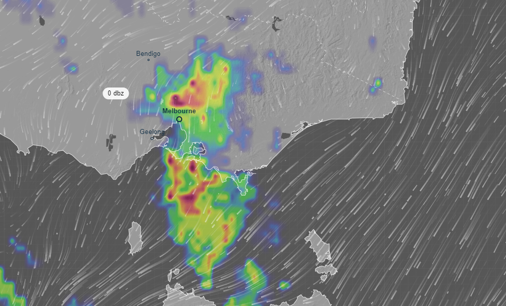
More severe thunderstorms and heavy rainfall are predicted to hit Victoria this afternoon and tomorrow after damaging storms were felt overnight.
Flash flooding occurred and as many as 4000 homes were left without power this morning due to heavy rainfall.
The Bureau of Meteorology's Diana Eadie said the risk of heavy rainfall across Victoria would continue for the rest of today and into tomorrow, particularly in the state's west, where large hail and damaging winds are likely.
"It was a very wet night and the risk of heavy falls will continue today and tomorrow," she said.
READ MORE: Bureau warns of 'life-threatening flash flooding'
"For today, the main area of concern is the west of the state.
"Tomorrow, heavier rainfall is much more likely over central Victoria."
The risk of heavy rainfall will also continue into the weekend for the east of the state, she said.
The Bureau of Meteorology has issued a severe thunderstorm warning for the south and west of the state, including around Colac, Port Campbell, Horsham and Torquay,
Ms Eadie said the risk of heavy rainfall will continue into the weekend for the east of the state, while temperatures were expected to lower on the weekend.
https://twitter.com/BOM_Vic/status/1486582019979108354
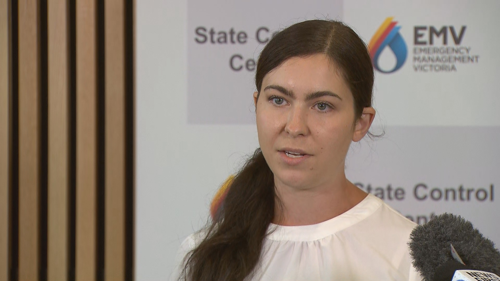
However, she said the high humidity "was here to stay".
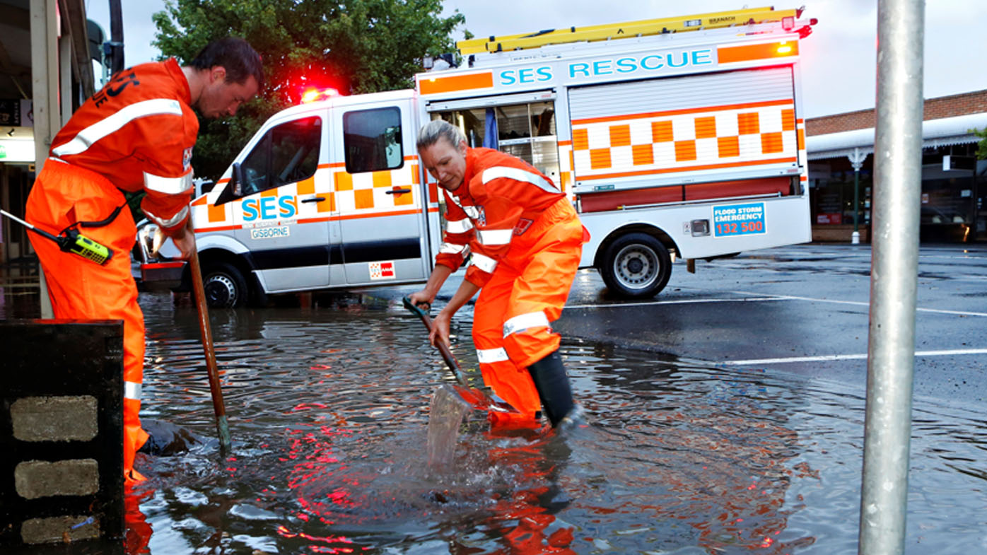
The SES has already responded to more than 350 requests for assistance across the state in the past 24 hours and State Agency Commander David Tucek said crews were expecting many more calls tomorrow.
He has urged Victorians to be prepared and to be vigilant and has warned people and drivers to stay out of floodwaters.
"It only takes 15cm of water to float a small car," he said.
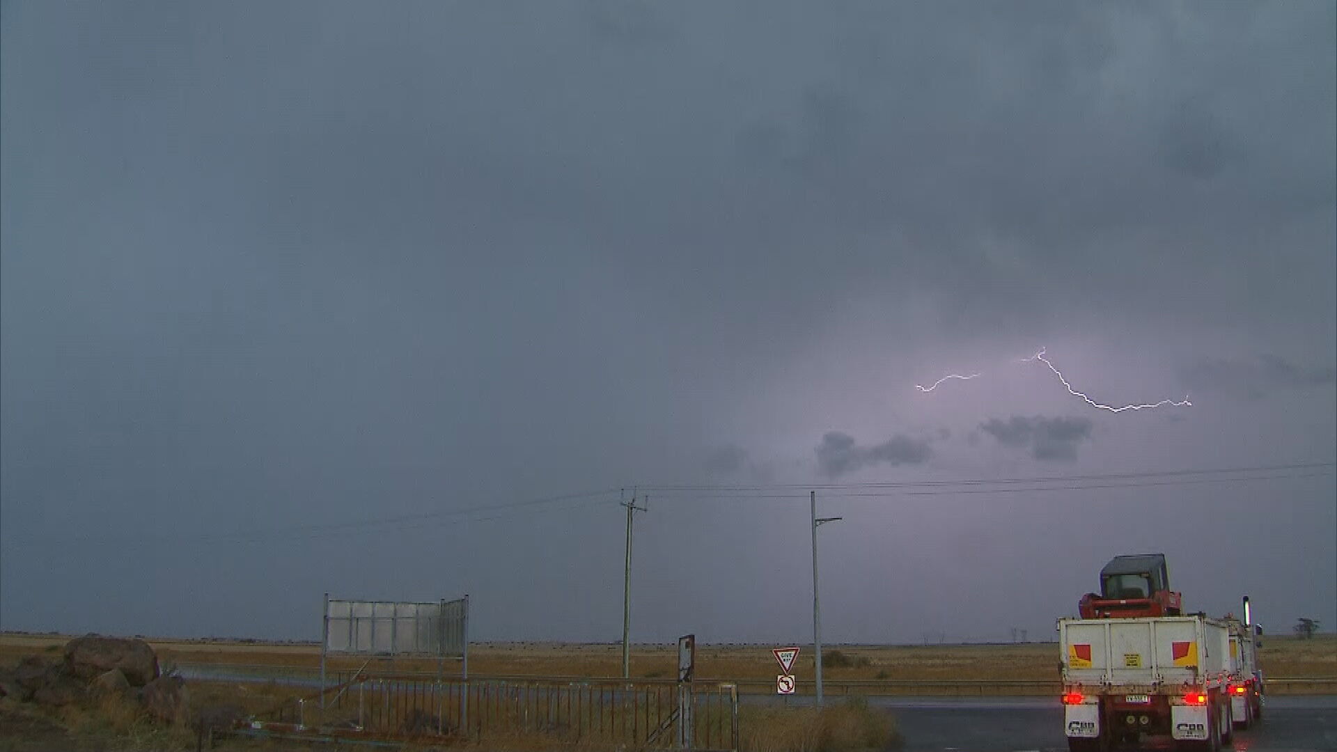
The Bureau of Meteorology (BoM) issued several weather warnings for "very dangerous thunderstorms" with intense rainfall that may lead to "life-threatening flash flooding" over northern and western Melbourne, and the southern Macedon Ranges, this morning.
https://twitter.com/BOM_Vic/status/1486424009340334087
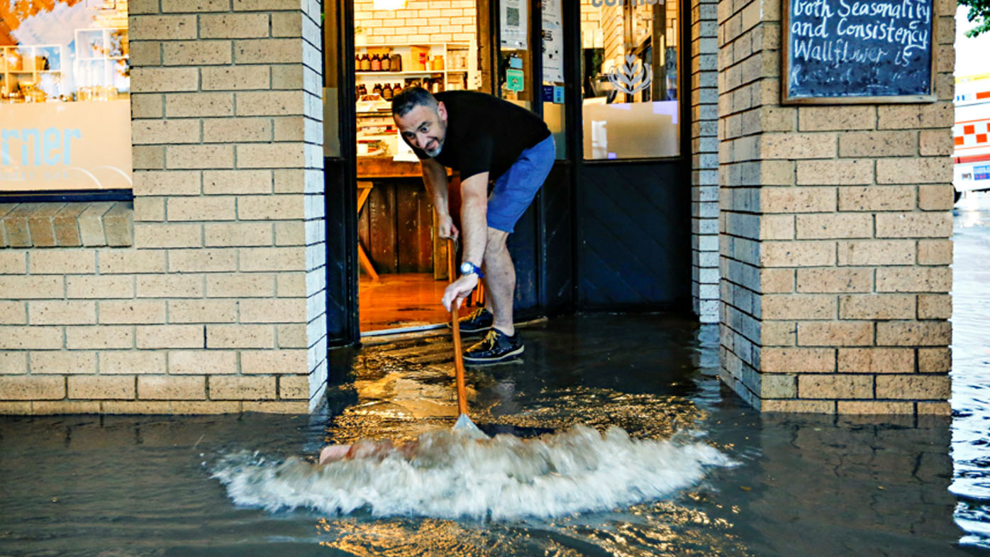
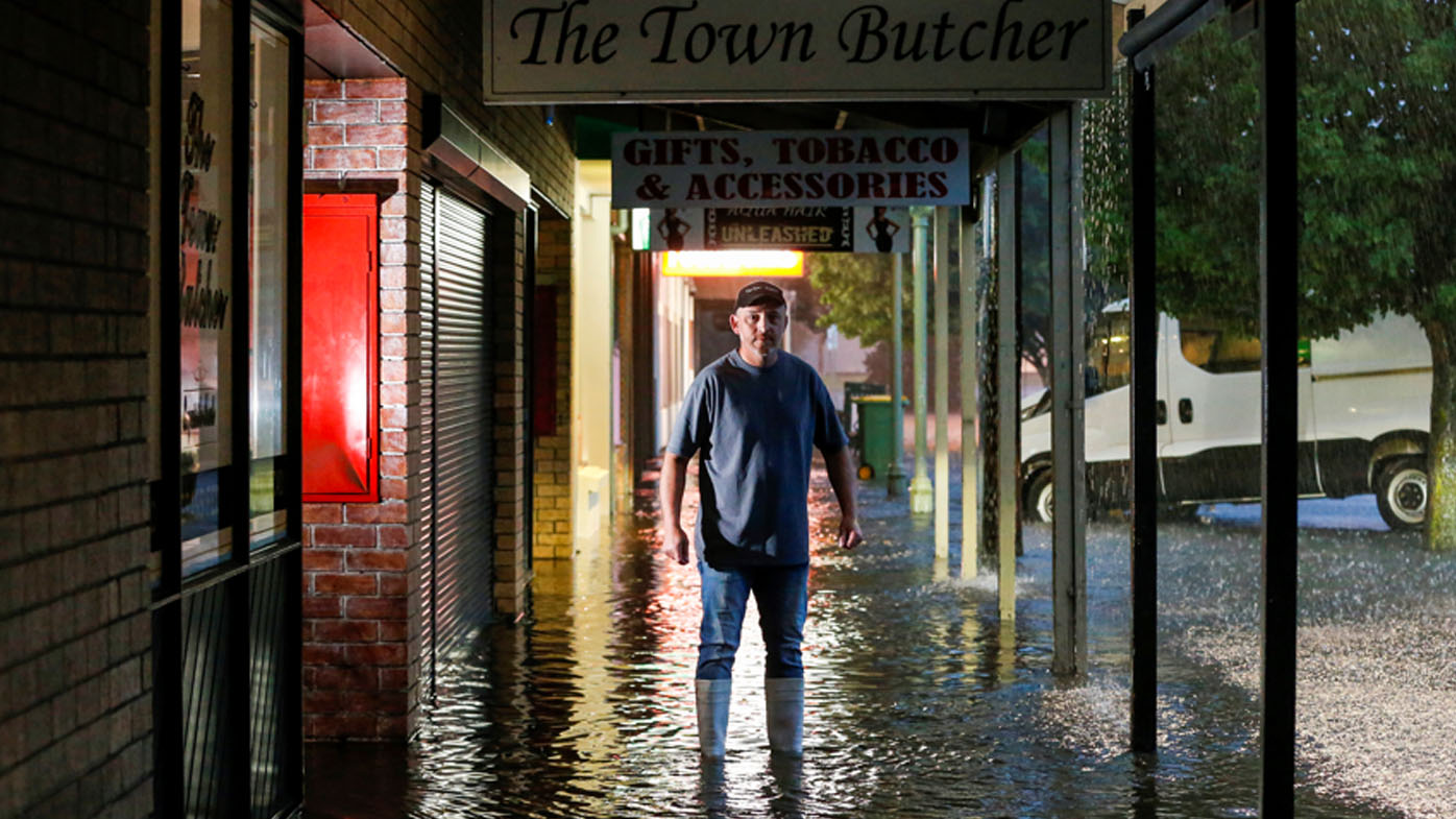
As many as 4000 homes were plunged into darkness after the storms swept in from north-western parts of Victoria, triggering flash flooding in regions such as Kyneton.
Photos show local traders in the town trying to salvage their businesses, pushing floodwaters out of their shopfronts as streets fill with pools of water.
The Telstra exchange building in Kyneton has also flooded, but services in the area have not been impacted at this stage.
Bureau of Meteorology meteorologist Jackson Browne said 56mm of rainfall was recorded this morning in just an hour.
"That is rainfall typically you would expect once per century," he said.
"So just to give you an idea of how high-end some of these rainfall rates are.
"We've got very tropical air over Victoria and Melbourne included. We are seeing very slow-moving thunderstorms which is why we're warning for severe thunderstorms leading to heavy rainfall."
Ms Eadie said Mildura had experienced its wettest January day ever.
She said 69mm of rain had fallen in just two hours there, while more showers and storms were still headed for the area.
More than 100 SES calls have been made in Mildura in the past 24 hours.
Meanwhile, fire tore through one house in Bundoora, Melbourne's north-east, after lightning struck the property about 8am.
Three residents were forced to evacuate the home and two were taken to the Austin Hospital for further observation.
"Multiple Triple Zero calls were received to alert FRV to a house struck by lightning in Bundoora this morning," Fire Rescue Victoria said in a statement.
"Fire trucks arrived on scene to find the roof of the single-storey brick veneer home well-involved in fire and threatening an adjacent property.
"Firefighters wearing breathing apparatus quickly established water hose lines to prevent spread to the adjoining property and contain the fire within the home."
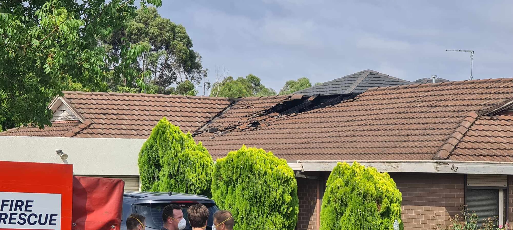
About 40 per cent of the home suffered "significant damage" with specialist fire investigators confirming a lightning strike caused the blaze.
Arthurs Creek, a town 33km north-east of Melbourne, recorded 41.6mm of rain in an hour and 57.8mm in 2.5 hours.
Nearby, Coldstream recorded 37.2mm in an hour.
READ MORE: Impressive lightning show in the Pilbara skies during storm
The Department of Health also issued a heat health warning, as yesterday became the hottest Australia Day in 16 years, with the mercury climbing to 36 degrees in Melbourne.
Last night the temperature did not dip below about 25 degrees in the city.
In Sydney, it will be partly cloudy with a maximum temperature of 28C and in Canberra a top of 29C.
Perth is set to swelter through its continued heatwave, with a top of 39C.
There is a chance of a possible storm in Adelaide, with temperatures climbing to 31C.
In Brisbane, it will be partly cloudy with a top of 30C.
Showers and a possible storm are forecast for Darwin, with temperatures reaching 32C.
In Hobart, showers are set to clear and it will be 27C.