As Queensland braces for a record rain event to hit "multiple areas and multiple regions" tonight, Western Australia is also preparing for a deluge.
Weatherzone says a late season tropical cyclone has formed over the Indian Ocean, which will see rain fall over WA later this week.
Cyclone Karim strengthened to a category two system last night.
ELECTION 2022: Morrison, Albanese clash in debate
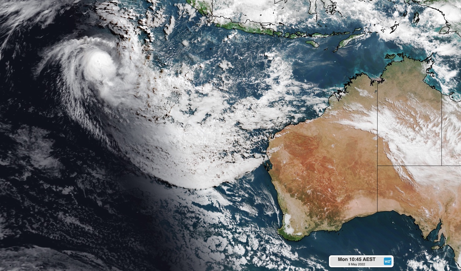
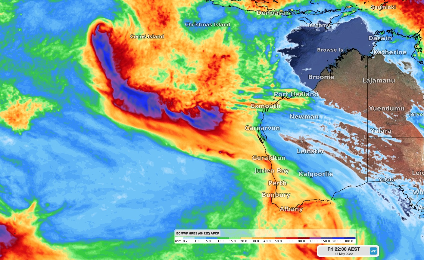
Despite it being the cyclone off-season, modelling shows parts of the state could receive 30mm of rain.
"Australia's tropical cyclone season officially ended more than a week ago on April 30," Weatherzone explained.
"However, unusually warm water over the eastern Indian Ocean has helped spawn an out-of-season tropical cyclone.
"Showers will start to increase over the west coast of WA from late Wednesday, before rain becomes heavier and more widespread on Thursday into Friday."
The low pressure system is not expected to make landfall.
ANALYSIS: What did we learn during The Great Debate?
Queensland prepares for deluge
A major wet weather event is also set to hit Queensland.
Most of the rain will fall along more than 700km of the central and northern parts of the coast, from Townsville down to Rockhampton and inland to Longreach and Winton.
READ MORE: Massive 450kg beast recorded swimming off US coast
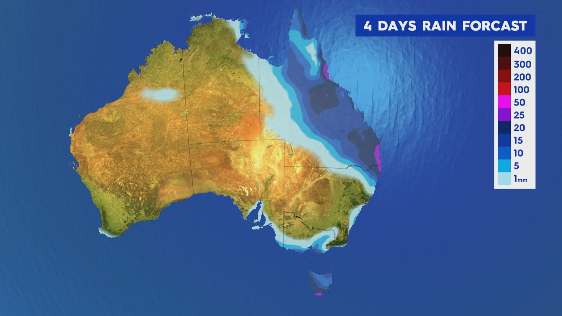
Towns in that area already received a lot of rain over the Anzac Day long weekend and catchments are very full.
Bureau meteorologist Jackson Browne said 100mm could fall on Longreach in outback Queensland.
"That is five times the monthly rainfall in May for Longreach," Browne said, adding that rainfall forecast is "conservative".
"It's very unusual for May.
"The responsible character is a large high-pressure system in the Tasman Sea.
"And that's drawing a huge north-easterly fetch of moisture down from the Solomon Islands."
READ MORE: Chris Dawson breaks silence on eve of murder trial

Browne said rain will develop over inland regions from tonight, with the system shifting toward the coast later tomorrow.
Up to 400mm of rain could fall on parts of the coast in just 48 hours, with the SES preparing for emergency situations.
The Bureau of Meteorology (BoM) said it was likely flood watch warnings would be released throughout the day.
People in the affected areas are urged to stay across the warnings and updates and keep off the roads if possible.
Tomorrow to Thursday is set to be the biggest danger period.
The state's south-east is not set to see as much rain, but a severe wind warning is in place for the region.
The Sunshine Coast is also bracing for a thunderstorm and up to 90mm of rain.