Brace yourselves, landlubbers – Australia's east coast could be set for a weather phenomenon with a name straight out of a pirate movie.
The coast is in for a soaking in the coming days, with heavy rains forecast for Queensland and New South Wales.
Two weather systems are bringing the deluge, prompting flood warnings across several regions.
READ MORE: Ute driver behind bars after triple bust on Easter long weekend
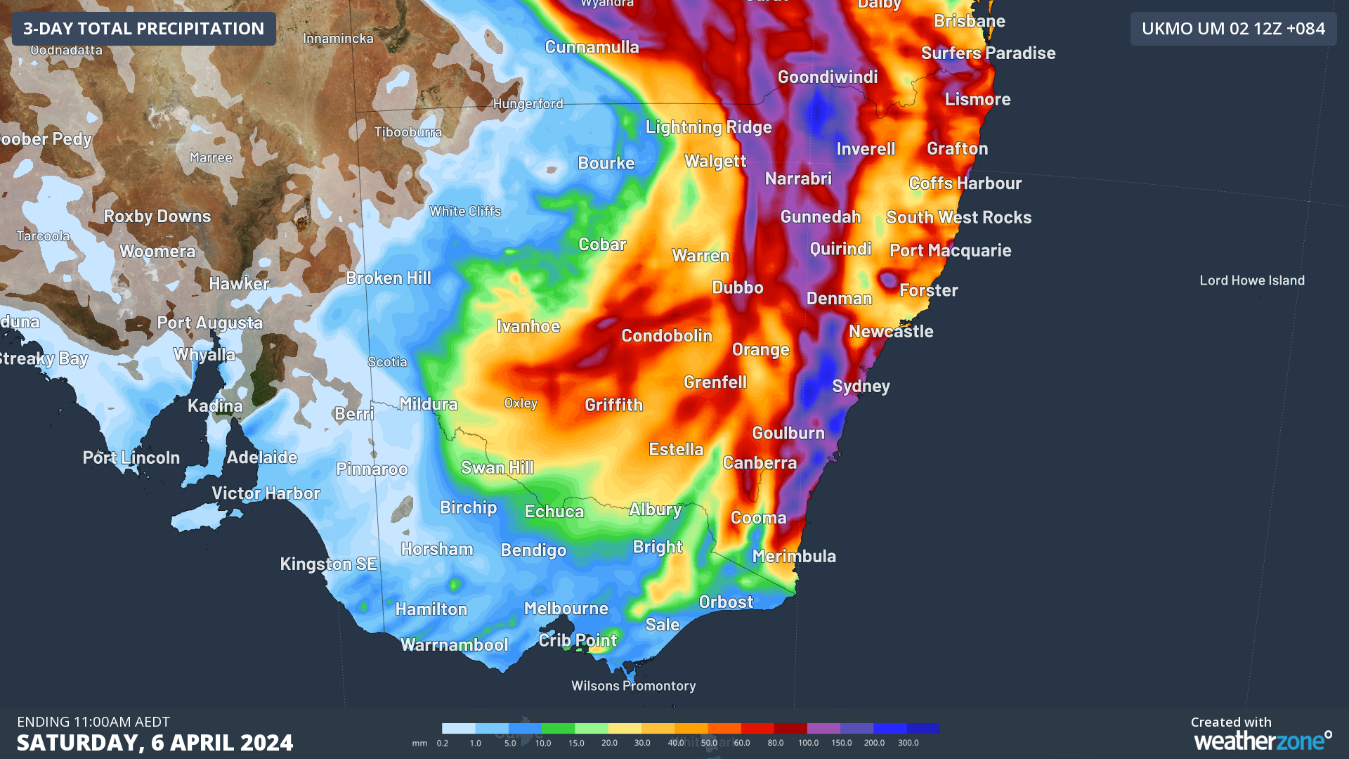
In southern Queensland and northern NSW, a low pressure system is expected to start producing storms and rain today into tomorrow.
This will be joined by a coastal trough that will funnel moisture from the tropics down along the coastlines of both states.
It could also lead to something magnificently dubbed a "black nor-easter".
"When a cut-off low and coastal trough interact at the same time, it is often a recipe for heavy rainfall and flooding along the east coast," Weatherzone said.
"The cold upper air cools down the warmer, saturated air, forcing large amounts of moisture to fall as rain."
This can lead to the aformentioned "black nor-easter", so named because of the dark clouds that can turn the skies black during the day.
The term was first written down in a 1911 edition of the Sydney Morning Herald.
Flood warnings in place
In New South Wales, warnings are in place around Sydney, the Hawkesbury, Liverpool, Tempe and Camden.
In the regions, warnings are also in place for the Northern Rivers region, the Mid North Coast, Wollombi Brook, the South Coast and parts of the state's north-west.
Further weather warnings have been issued for the Hunter, Northern Tablelands, Illawarra, South Coast, Central Tablelands, Southern Tablelands, North West Slopes & Plains, Central West Slopes & Plains, South West Slopes, Riverina, Snowy Mountains and Australian Capital Territory forecast districts.
However, a thunderstorm warning for the north of the state has been cancelled.
Flood warnings are also in place on multiple Queensland rivers, including the Diamantina, Leichhardt, Flinders, and Norman.
Drivers urged to take care
New South Wales motorists have been urged to "take extreme care" on the roads as severe weather is forecast for the next few days.
An estimated 300mm could hit Sydney in the next 48 hours, causing flash flooding and dangerous road conditions.
Those travelling to or from the Illawarra and Hunter, Nepean and Blue Mountains should expect severe weather.
"For those who need to travel, please take your time and plan ahead by checking Live Traffic NSW to see if your route is impacted by severe weather," Executive Director of Customer Journey Planning Craig Moran said.
"Drive to conditions, turn your headlights on and allow plenty of distance between you and the car in front.
"Do not drive through flooded roads. If weather conditions become too severe, find a safe place to stop and wait until it passes.
"Passengers catching public transport should plan ahead, check timetables and allow extra travel time."
READ MORE: Strongest earthquake in 25 years rocks Taiwan, killing nine people and stranding 70 workers in quarries
A powerful low-pressure system is moving towards both states, which will combine with the effects of a trough making its way down the coast.
Residents in affected areas are urged to put together their essential supplies, including important documents and medicines, in case they have to leave.
Some models suggest as much as 150mm could fall in just six hours, with severe thunderstorms also possible.
FOLLOW US ON WHATSAPP HERE: Stay across all the latest in breaking news, celebrity and sport via our WhatsApp channel. No comments, no algorithm and nobody can see your private details.