Residents in Western Australia have been warned to brace for rainfall in excess of 500mm and damaging winds as Tropical Cyclone Zelia moves towards the coast.
The cyclone progressed to a category 2 system at 11am (AWST) with sustained winds near the centre of 95km/h and gusts up to 130km/h.
The system, which is moving slowly towards the coastline, is sitting about 180km north of Port Hedland.
READ MORE: 'Challenging period': Sam Kerr speaks after UK court hands down decision
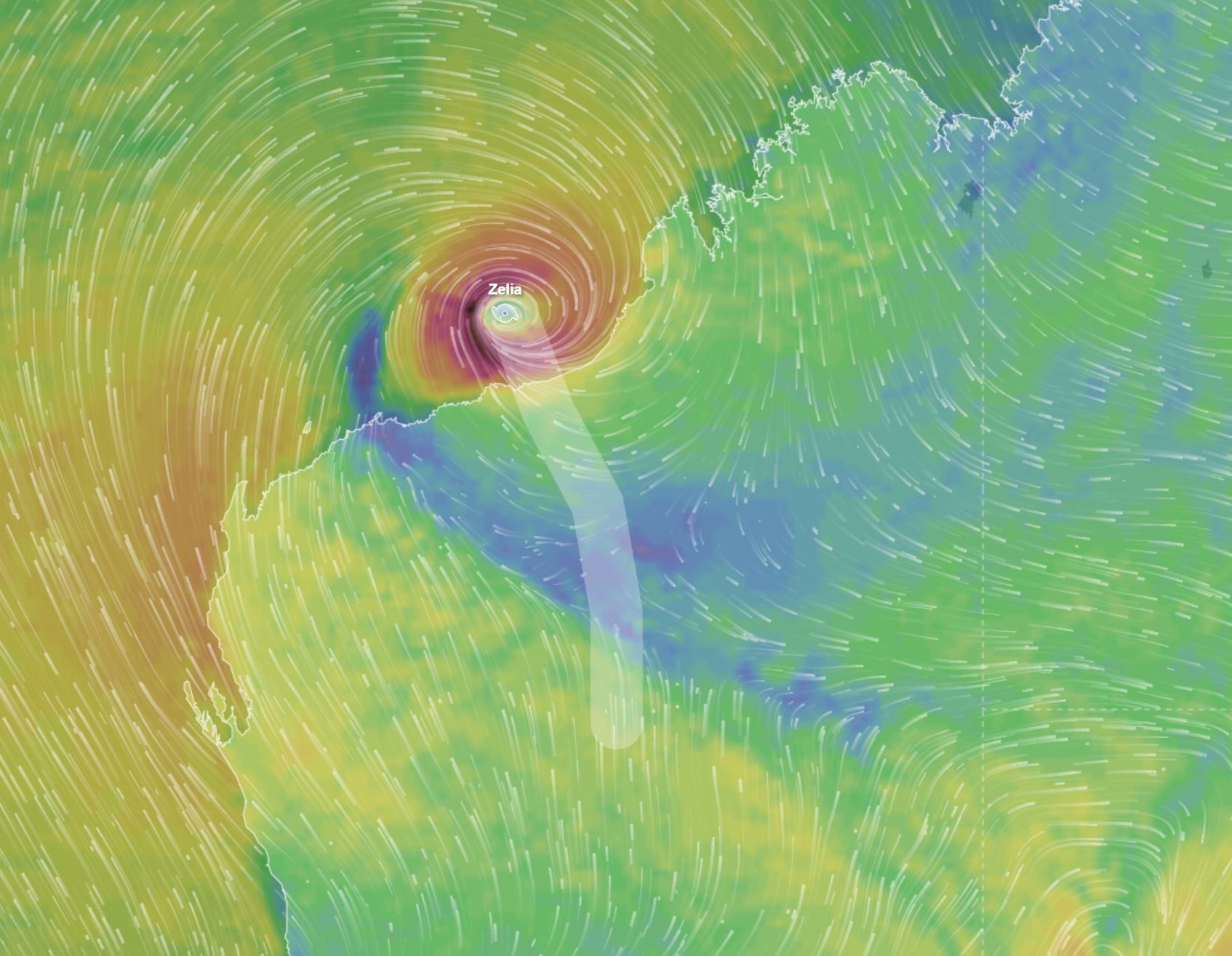
Bureau of Meteorology state manager for Western Australia James Ashley said the system "is expected to take a bit of a wobble to the west" before resuming a southwards motion tomorrow.
"A real feature of this system is that it's quite erratic and slow-moving off the Pilbara coast," Ashley said.
The cyclone is likely to develop into a category 3 before crossing the east Pilbara or adjacent west Kimberley coast around Friday.
READ MORE: Why Australia should listen to Donald Trump about the Panama Canal
Ashley said areas in the path of the weather system could see in excess of 500mm of rain over the course of the event.
Meteorologists have warned residents between Port Hedland and Bidyadanga of the potential of a dangerous storm tide as the cyclone centre crosses the coast.
"Tides are likely to rise significantly above the normal high-tide mark with damaging waves and dangerous flooding of some low-lying areas close to the shoreline," the Bureau of Meteorology said.
Gales with damaging wind gusts of 120km/h are developing near the coastal fringe between De Grey and Wallal Downs.
This could extend along the coast between Bidyadanga and Dampier including Port Hedland and Karratha today.
The damaging winds could then extend west to Mardie from late tomorrow, if the system moves further west than forecast.
Damaging wind gusts to 120km/h may also extend inland to Nullagine during Friday.
Destructive wind gusts of up to 160km/h may develop between between Whim Creek to Wallal Downs tomorrow as Zelia moves closer to the coast.
Very destructive wind gusts of up to 220km/h may develop between Whim Creek to Wallal Downs tomorrow evening.
A flood watch is also current for catchments in the Pilbara and western Kimberley.
Visit the Bureau of Meteorology website for the latest warnings and advice.
DOWNLOAD THE 9NEWS APP: Stay across all the latest in breaking news, sport, politics and the weather via our news app and get notifications sent straight to your smartphone. Available on the Apple App Store and Google Play.