Thunderstorms are sweeping across Australia's east coast, bringing heavy rainfall, wind gusts and large hailstones.
Brisbane and other parts of south-east Queensland appear to have copped the worst of it so far, and the Bureau of Meteorology has warned the wild weather there and in NSW and Victoria is expected to stretch across the weekend.
There was flash flooding in Boonah in Queensland's Scenic Rim while hail up to seven centimetres was reported near Goondiwindi earlier this afternoon.
READ MORE: Kmart recalls play sand products over asbestos concerns
There were rain delays on the Sunshine Coast between Beerwah and Beerburrum with some services held up for almost an hour due to a signaling issue.
Meteorologist Shane Kennedy said the wild weather, which began last night, would continue tomorrow.
"Overnight on Saturday into Sunday, showers will develop into quite a broad rainband extending from the north-west all the way down to the south-east," Kennedy said.
"There is still that potential we could see further severe thunderstorms for the third day in a row ."
There were several severe storm warnings in place tonight for damaging winds, large hail and heavy rain for residents on the Sunshine Coast, Gympie, Somerset, Ipswich, Toowoomba, Gold Coast and surrounding areas.
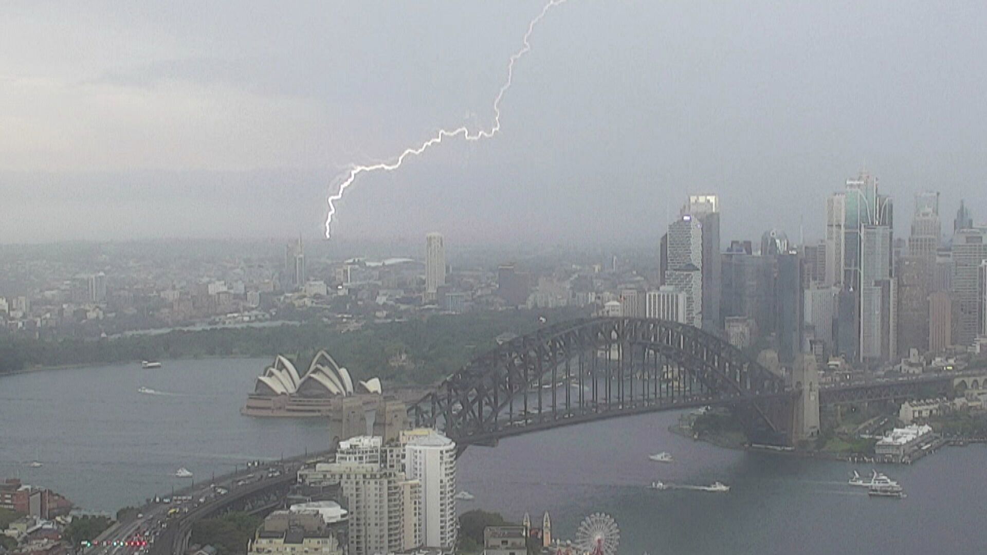
Sudden storm hits Sydney
A snap storm caused delays at Sydney Airport this afternoon which left about a dozen planes unable to land.
Pilots circled the airport as they waited for the storm to pass.
Flights have since returned to normal.
A strong north-easterly storm hit the city's south and south-west the hardest.
The weather system brought heavy rain and gusts of 80km/h were felt in Penrith.
While the thunderstorms in NSW have eased, the bureau said they could redevelop.
A severe weather warning was in place tonight for central and northern parts of NSW.
READ MORE: Teen charged after pregnant woman and unborn baby die in Sydney crash

BoM meteorologist Angus Hines said severe thunderstorms had been most likely to occur in parts of Queensland today.
"This is not only where severe thunderstorms are most likely to occur today, but this is where we could see even more significant weather impacts in the form of giant hailstones, potentially five centimetres or greater, and destructive winds 120km/h or stronger," Hines said.
"The region where we could see those really high-end impacts goes from western parts of Brisbane and the Sunshine Coast up into the hinterlands, across Toowoomba, into the Darling Downs then across the southern border ranges and into the north-western slopes of NSW."
DOWNLOAD THE 9NEWS APP: Stay across all the latest in breaking news, sport, politics and the weather via our news app and get notifications sent straight to your smartphone. Available on the Apple App Store and Google Play.