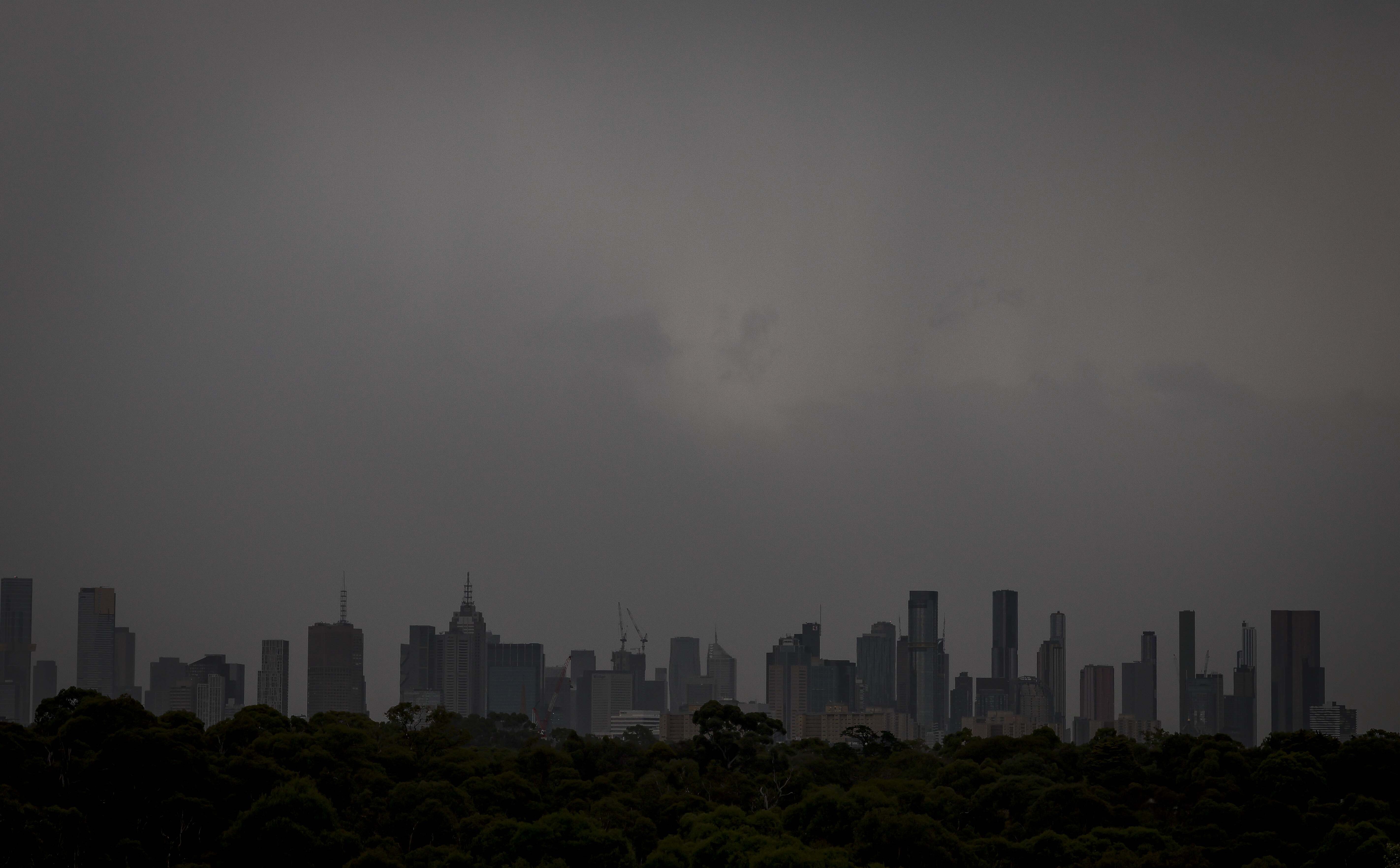
Residents across Victoria are warned not to be fooled by clearing skies, with more wet weather to follow a fast-moving storm that battered the state earlier today.
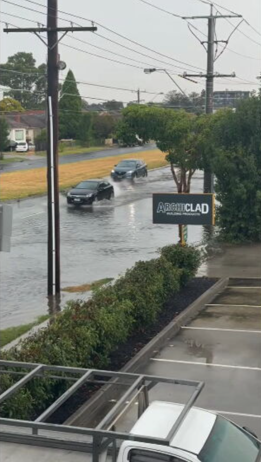
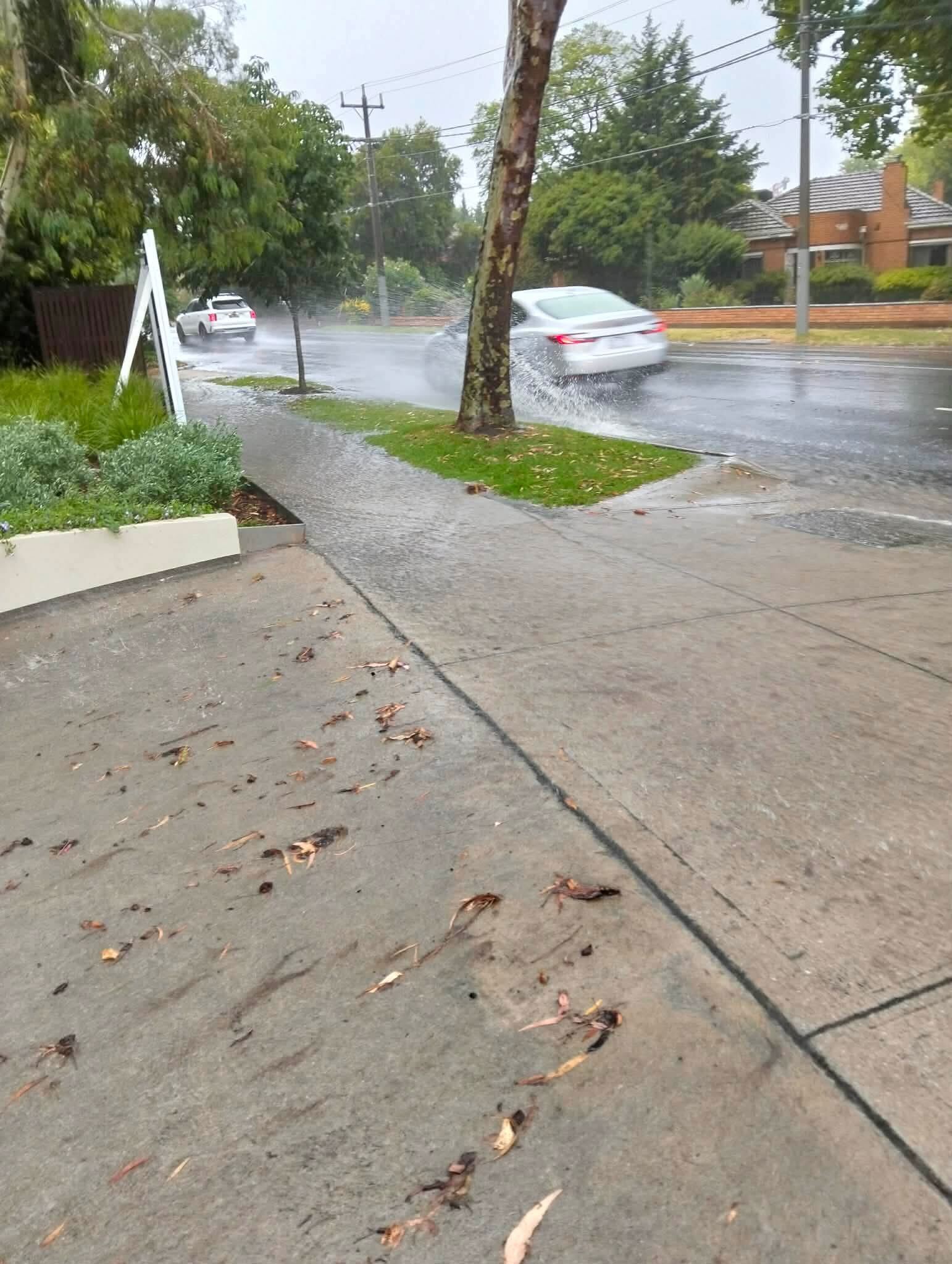
Storms passed over the city this afternoon, causing flash flooding and power outages for more than 7000 homes, but intense rainfall is still impacting large parts of the state.
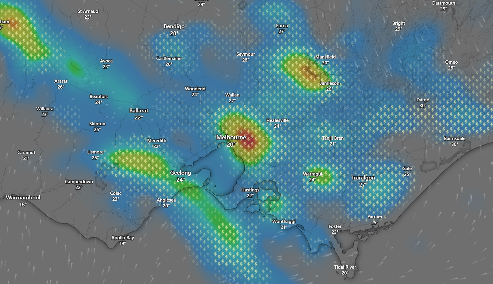
A severe thunderstorm warning was earlier issued for Melbourne's northern, eastern and southern suburbs – stretching as far as South Gippsland – this afternoon and residents in multiple suburbs were warned to stay inside.
LATEST: Remains found in search for kidnapped Sydney grandfather
"Very dangerous" storms swept across Greensborough, Camberwell, Preston and Resevoir in Melbourne at 2.50pm and the wild weather has travelled south and south-east.
Across the state, 171 calls for help have so far been issued, including 60 for building damage, 50 for flooding and nearly 30 calls for reports of trees down.
Heidelberg and Reservoir in Melbourne's north are the epicentres of those assistance calls according to the State Control Centre, with 24 SES units deployed to Heidelberg.
Nearby suburbs including Preston, Coburg and Craigieburn, were earlier issued with an emergency warning from Vic Emergency.
Up north, residents in Mildura, Swan Hill, Ouyen, Kerang, Walpeup, Robinvale, Birchip and surrounding suburbs have been told to stay informed as the storms move inland across Victoria this evening.
Those across most of Gippsland, from Drouin in West Gippsland to Bairnsdale and Lakes Entrance in the East have also been warned to stay indoors tonight.
While the worst of the storms have passed over Melbourne, another band of rain could bear down on the state later this evening.
"We're going to see multiple rounds of showers and storms right across the state," Bureau of Meteorology's Dean Narramore said.
"We're seeing more heavy thunderstorms develop to the west of Swan Hill, through Sea Lake and then to the north of Bendigo and that's what's gonna move south in the coming hours.
Storm cells from the north and south could converge over Melbourne and trigger minor flash flooding later tonight, Narramore said.
"All that rain in the northern areas could approach the Melbourne area in the evening and overnight."
Parts of the Wimmera and Mallee, specifically north of Bendigo up towards Ouyen, as well as East Gippsland will also be in the firing line.
Bureau of Meteorology senior forecaster Daniel Hayes told ABC Radio Melbourne that some areas were soaked with one milimetre per minute of rainfall during the worst of the storm this afternoon..
"We have seen a few places that have been coming close to that one millimetre per minute," Hayes said.
Gisborne, located north-west of Melbourne, was smashed by 32.2mm of rain in the one hour until 2.24pm.
Nearby Spring Hill was inundated with 38.4mm in just over an hour before 2pm.
More than 7000 residents were without power across the city at around 4pm. That dropped to 3000 by 6pm.
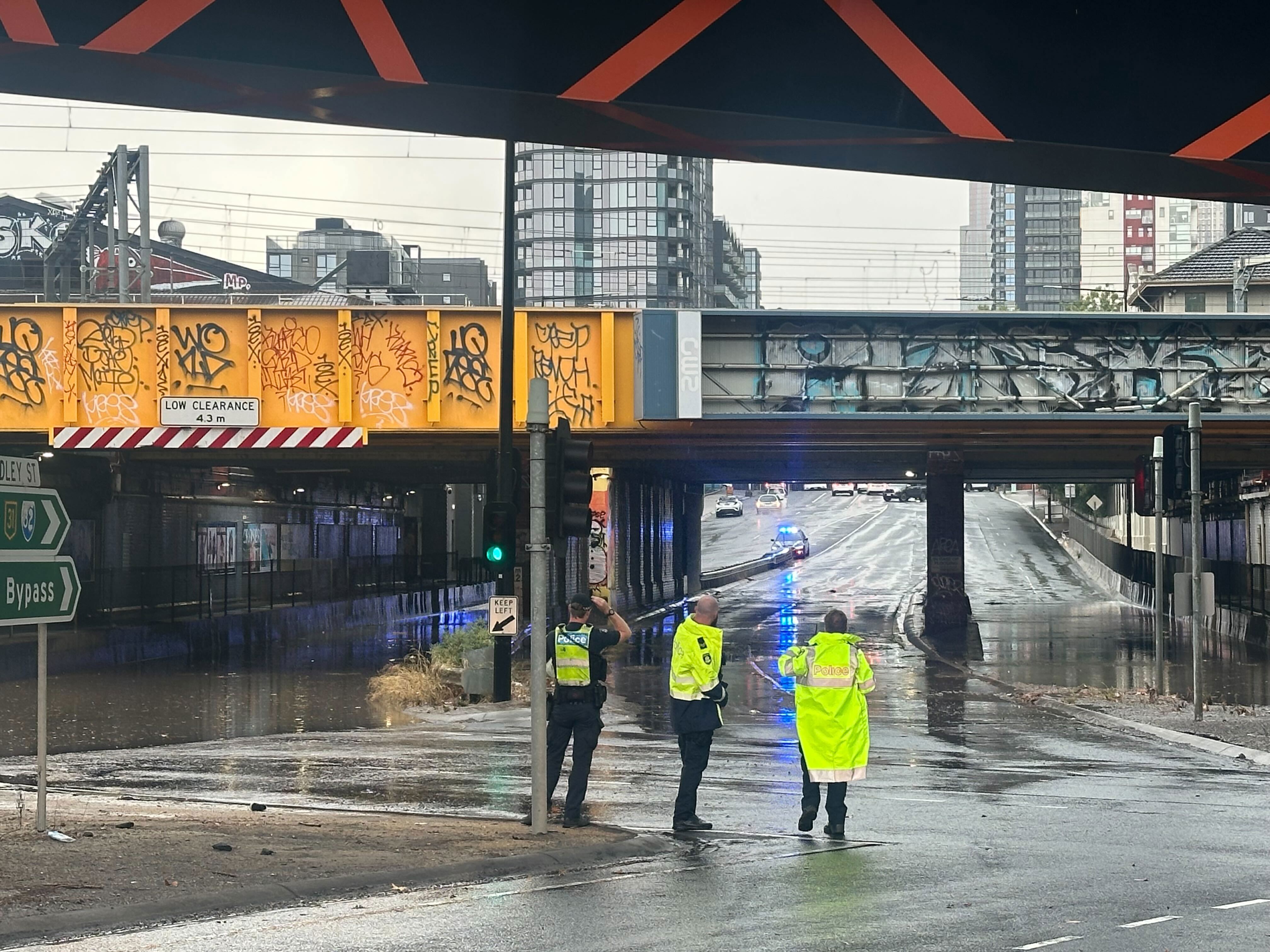
The Dudley Street overpass in West Melbourne flooded as the skies opened and a rain bomb was unleashed on the Victorian capital.
Two cars became submerged as they drove through the area, with the flash-flooding seemingly coming out of nowhere.
The water subsided quickly and nobody was hurt.
The bridge at York Street in South Melbourne has been closed due to flooding.
Melbourne Airport in the city's northern fringes was also battered by rain, with a large blanket of fog also spreading over the tarmac.
Lightning was recorded just eight kilometres from the airfield, causing delays for some due to land on the tarmac.
A Virgin Australia flight from Hobart due to arrive at 2.15pm was diverted and headed back to Tasmania.
NATIONAL: Design for Trump's first tower resort in Australia revealed
Conditions are expected to move through eastern parts of Victoria and potentially south-eastern parts of NSW tomorrow.
Motorists and commuters are warned to drive safely, allow extra travel time and be alert to allow extra travel time and stay alert for hazards. These hazards could include fallen trees, debris, damaged power lines and localised flash flooding.
"If severe weather is impacting your area, consider delaying travel where possible and staying indoors until conditions improve. Never drive through floodwater," VICSES chief officer of operations Alistair Drayton said.
READ MORE: One award after another for Oscar front-runner at BAFTAs
Victoria already had a taste of the extreme weather on Sunday, with parts of the state battered by up to 40 millimetres of rain in the 24 hours to 9am yesterday.
There was localised flash flooding in the Wodonga area, sparking 90 calls for assistance from VICSES.
All up, SES volunteers responded to about 250 requests for assistance across the state between midday on Sunday and 10am yesterday.
"Thank you to the dedicated volunteers who worked throughout last night to assist impacted communities and remain ready to respond as further storms approach this week," Drayton said.
Sydney will also face the possibility of heavy rain from tomorrow afternoon.
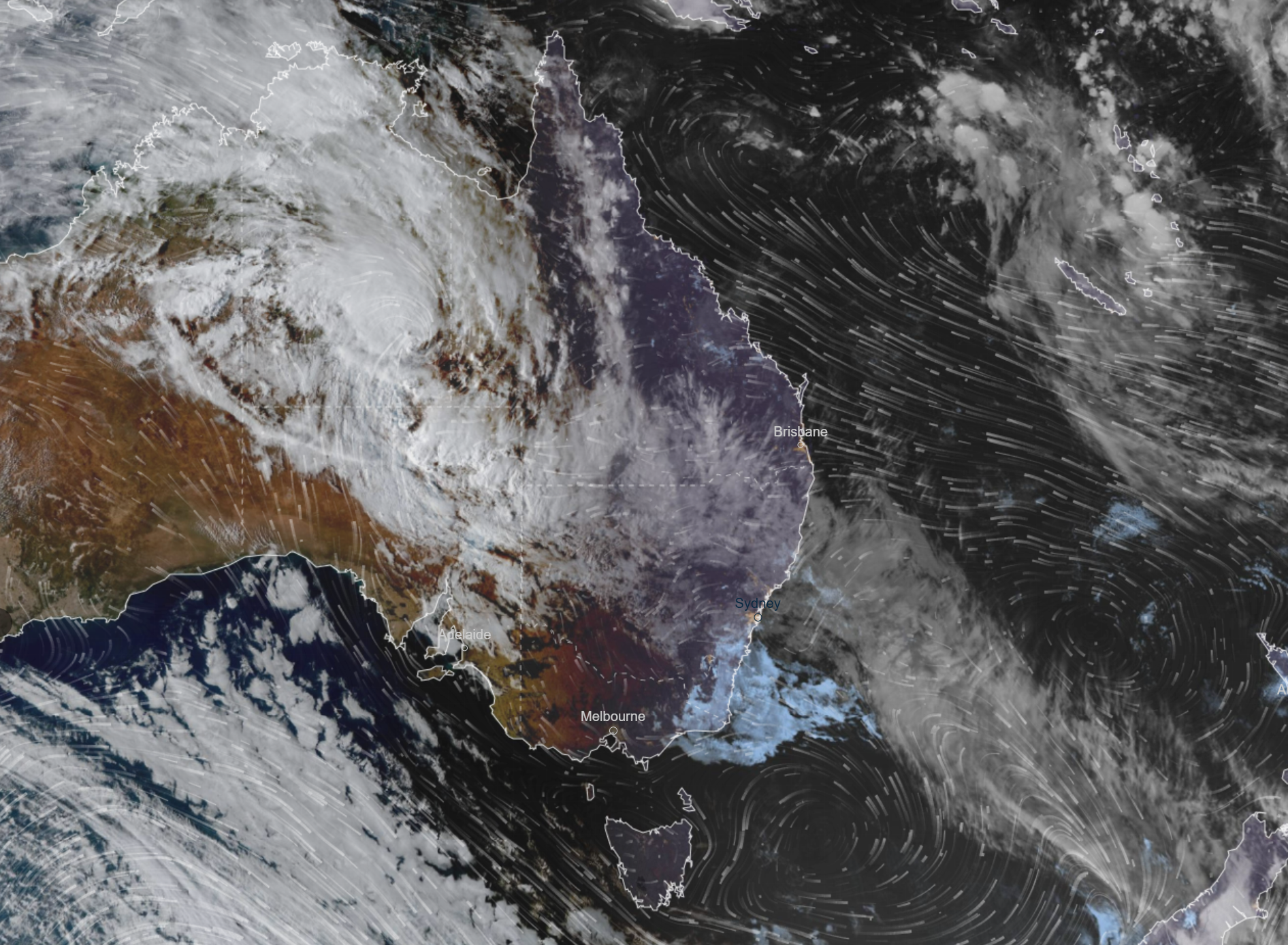
What was set to be a record-breaking dry summer across swaths of inland Australia has ended dramatically, with a torrential downpour bringing widespread flooding in the final days of summer.
Before last weekend, much of inland Australia had not seen any rainfall for two to three months.
An area the size of Greenland is on flood watch, from the top of the Northern Territory, into Queensland, NSW and down into agricultural regions of South Australia.
NEVER MISS A STORY: Get your breaking news and exclusive stories first by following us across all platforms.
- Download the 9NEWS App here via Apple and Google Play
- Make 9News your preferred source on Google by ticking this box here
- Sign up to our breaking newsletter here