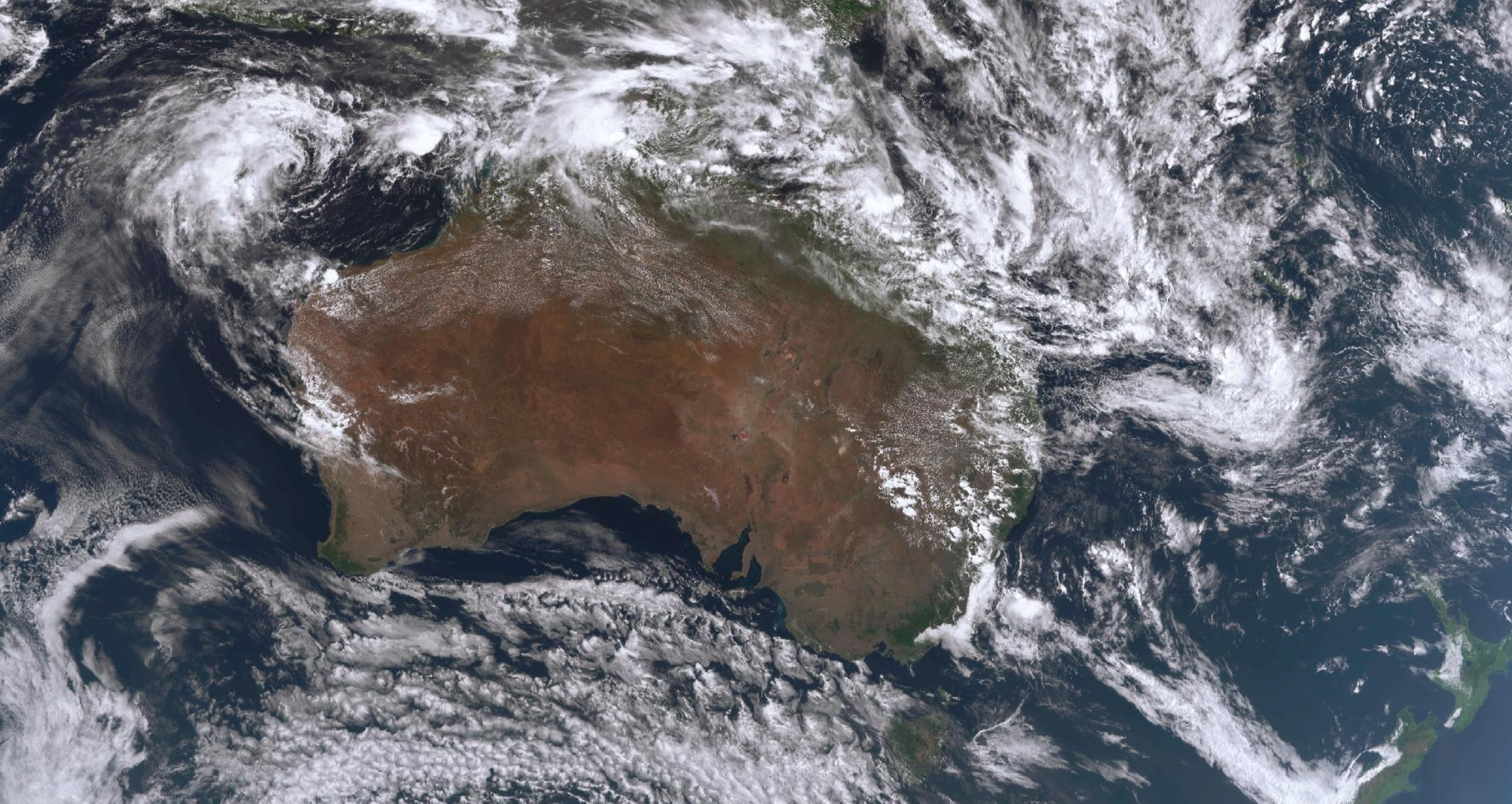
Twin tropical lows are dumping heavy rainfall across large parts of northern Queensland and the Northern Territory, with Katherine facing its worst flood disaster in decades.
A major flood warning is in place for the outback town, 300km south of Darwin, as well as nearby Nitmiluk, as the Katherine River rises rapidly.
It reached the moderate flood level of 16.75 metres earlier today and is expected to reach the major flood level of 17.5m, near March 2000 flood levels, this afternoon, according to the Bureau of Meteorology.
READ MORE: Man found dead in home north of Brisbane
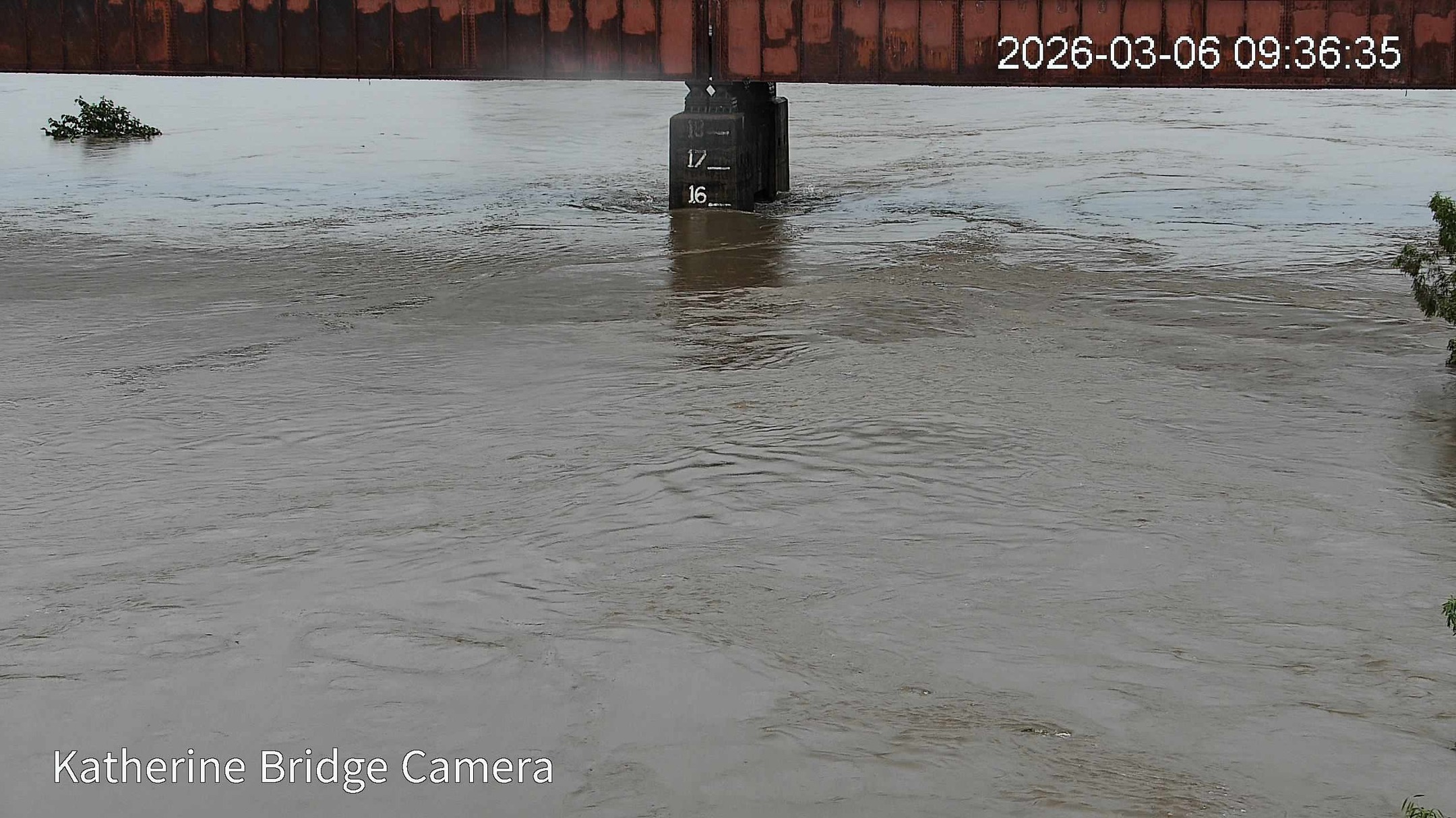
Katherine Hospital has been evacuated, with all patients being transferred to hospitals in Darwin due to flooding in the area.
"Further rainfall is expected during Friday, which may cause higher river level rises," the bureau warned.
The system is expected to move further west and a major flood warning is also in place for the Daly River with more general warnings for much of the Top End towards the Western Australian border.
Another tropical low sitting offshore from Cairns is due to cross the Queensland coast this afternoon and has already dumped more than 400mm on the Daintree River and 200mm on Cooktown.
Millions are prepared for a wet weekend as the system, while now unlikely to become a tropical cyclone, is expected to bring heavy rain as it tracks inland and south, reaching Brisbane and the south-east coast by Sunday.
READ MORE: Fresh interest rate hike is coming in May, economists warn
"Once the low crosses the coast today, it will move further towards the west and gradually turn and move towards the south over the weekend, but as it does, it'll also start to draw in a lot of tropical moisture, and that's with the surface trough which is lying over inland eastern parts of Queensland," Bureau of Meteorology forecaster Jonathon How said.
"This will bring increased showers and rain to most northern, central and eastern districts."
River catchments across northern Queensland are saturated and further flood warnings could be issued, he warned.
The bureau has issued a warning for heavy to locally intense rainfall that extends from north of Tully, north towards North Cook down to Cape Melville and inland, taking in Cairns, Port Douglas, Daintree, Cooktown, and the Atherton Tablelands.
That area is being warned of six-hourly rainfall totals between 80 and 240mm and 24-hour totals of 300mm.
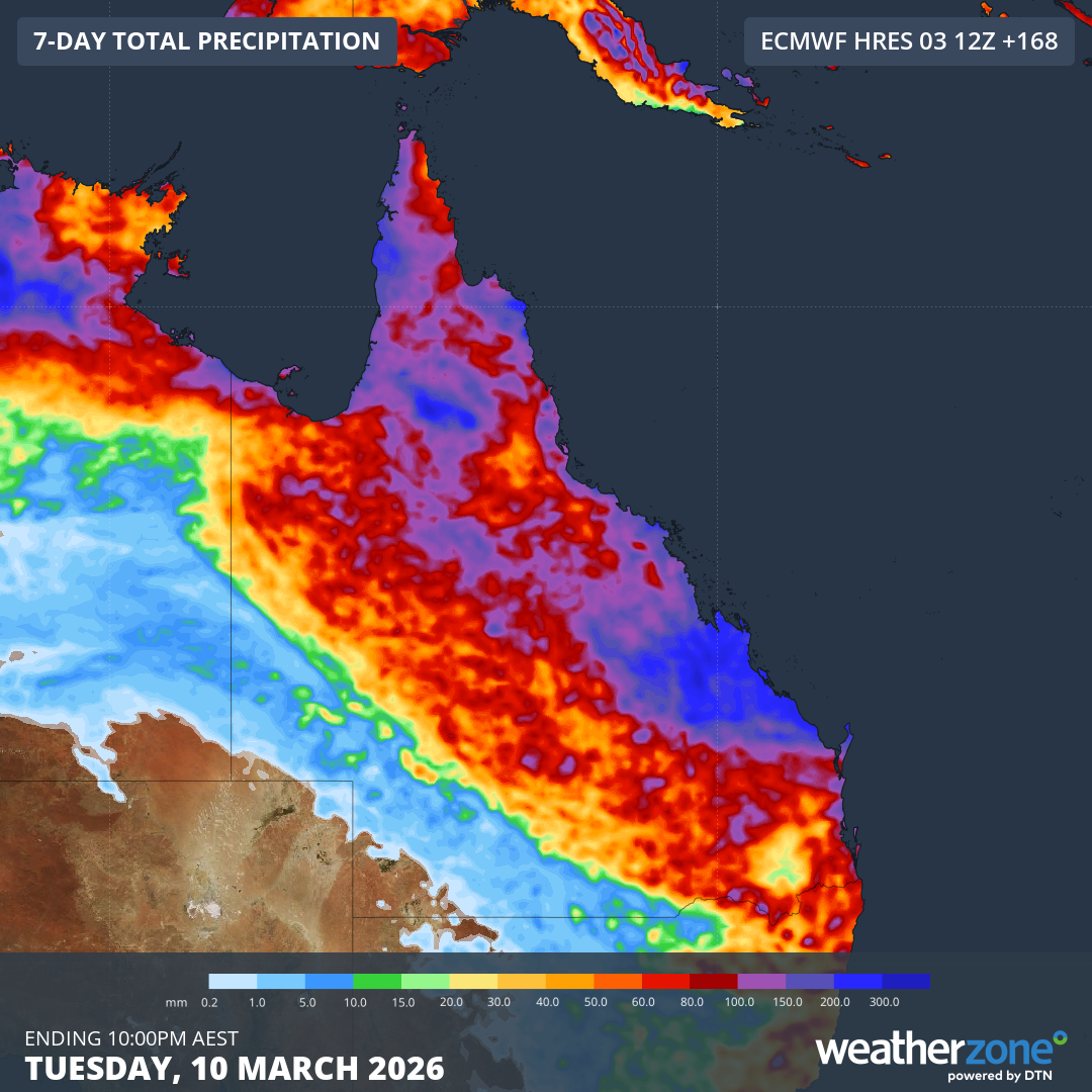
The rain is expected to spread south to Townsville and then Mackay, before hitting the Wide Bay and Darling Downs tomorrow as well as Brisbane, the Sunshine Coast and Gold Coast by Sunday.
"On Saturday, we'll see a few showers, but they will mostly build towards the late evening and Sunday will be the wettest day across southeast Queensland," How said.
"There is increasing confidence that we could see moderate rainfall totals in the range of 50 to 100 across south-east Queensland, including Brisbane on the Sunday, and we could also see higher isolated falls."
Brisbane can also expect slightly cooler temperatures with a top of 26 degrees over the weekend.
NEVER MISS A STORY: Get your breaking news and exclusive stories first by following us across all platforms.
- Download the 9NEWS App here via Apple and Google Play
- Make 9News your preferred source on Google by ticking this box here
- Sign up to our breaking newsletter here