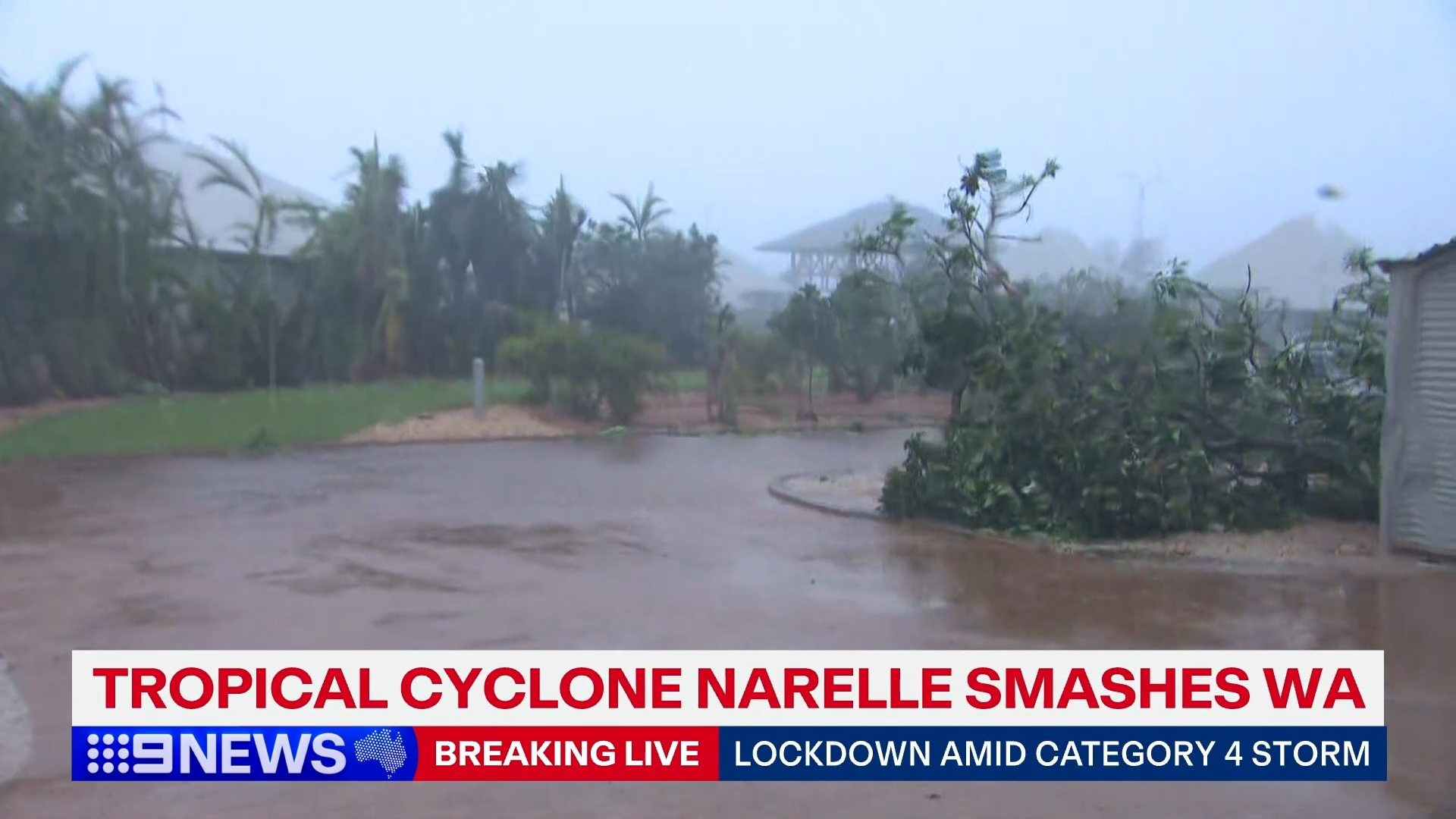
Tropical Cyclone Narelle has made landfall for the third time, crossing south of Coral Bay this afternoon as a category 3 storm.
The crossing came after the severe tropical cyclone pummelled parts of the West Australian coastline, ripping roofs from homes in Exmouth as it tracked south.
The historic system – which has already hit Queensland and the Northern Territory before sweeping out to sea and re-intensifying – was expected to impact an 800km stretch of coastline from the Pilbara down through the Gascoyne region today.
READ MORE: Easter road trips canned, cafes weigh surcharge as fuel prices sting
The Bureau of Meteorology warned the "very destructive core", which is generating wind gusts of up to 205km/h, is "moving south-southeast with severe impacts occurring on the northern Gascoyne and far western Pilbara coasts".
"Although Narelle is weakening, severe impacts at Carnarvon remain possible this afternoon as Narelle passes by to the east," it cautioned.
Narelle passed 30km to the west of Exmouth this morning as a category 4 system, and residents reported some homes have lost roofs.
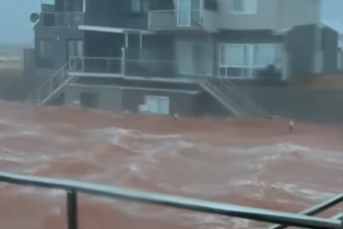
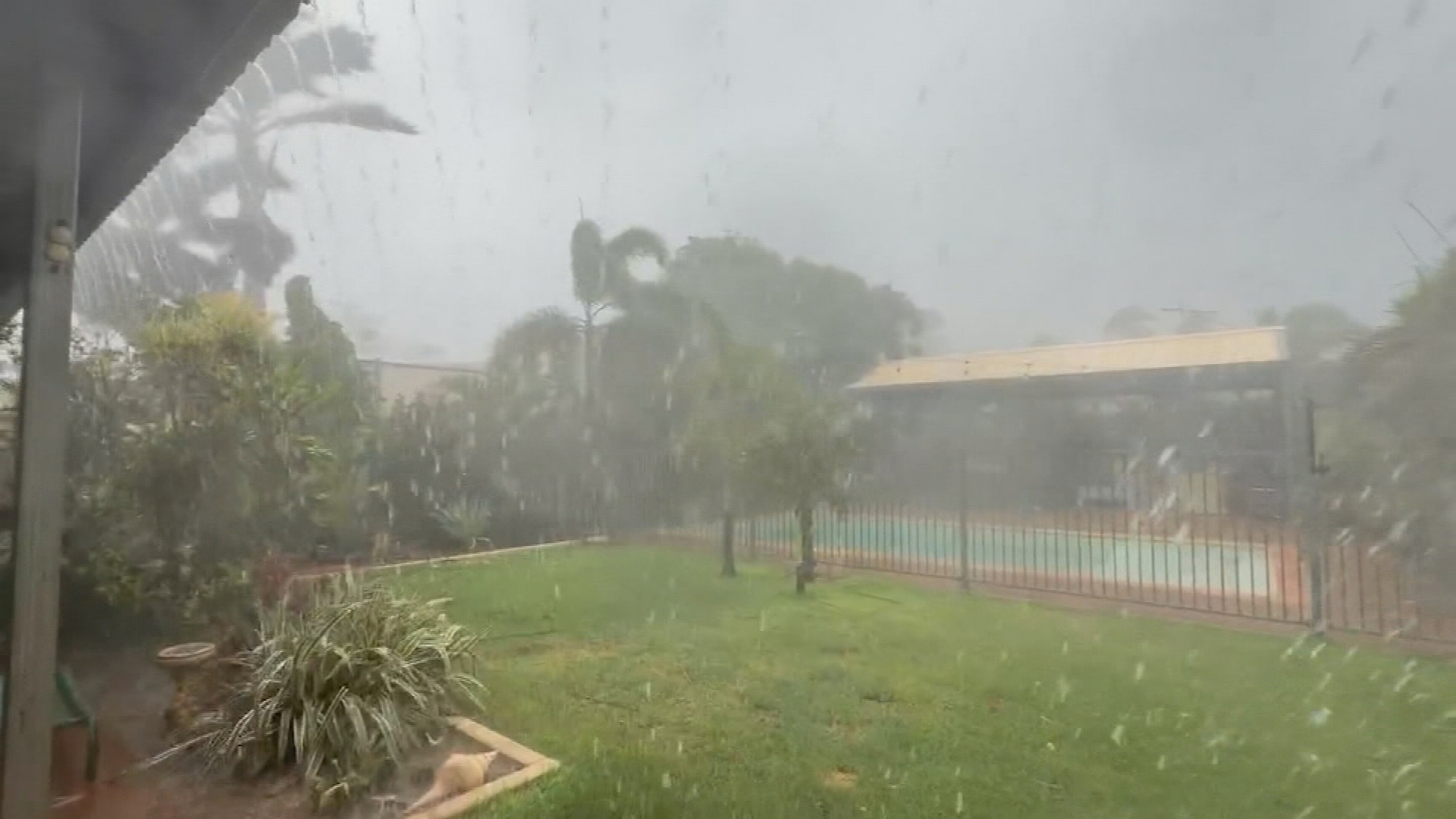
Video shows flash flooding following warnings Narelle will bring a dangerous storm tide and damaging waves to the Gascoyne coast.
West Australian Premier Roger Cook said it was a confronting situation for residents and emergency services.
"We know everyone in the north-west is made of tough stuff, but our thoughts are with you all," Cook said.
The severe weather system is sitting about 140 kilometres north of Carnarvon and is likely to severely impact the region before weakening.
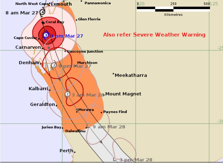
"While the system is expected to slowly weaken as it moves overland between Coral Bay and Cape Cuvier, it is likely to still be a category three system as it moves just inland from Carnarvon and Shark Bay," meteorologist James Ashley said.
Department of Fire and Emergency Services Commissioner Darren Klemm said there had been no reports of injury so far up until this afternoon.
"We've had 25 calls for assistance across the Pilbara, including 12 in Exmouth and 11 in the mid-west Gascoyne," Klemm said.
It will still be several hours before emergency services are able to fully assess the damage.
Bureau meteorologist Christie Johnson earlier said the system is expected to weaken as it moves past Carnarvon and Denham and approaches Kalbarri and Geraldton.
A warning zone extends west of Onslow to Jurien Bay, including Exmouth, Coral Bay, Carnarvon, Denham and Geraldton, and extending inland to Murchison and Dalwallinu.
"As it moves further south, it will weaken to a category 2 as it comes past Kalbarri and Geraldton, most likely becoming a category 1 as it moves inland of Dongara," Johnson said.
"After that, it will drop below tropical cyclone strength as it moves across the South West Land Division, eventually exiting Western Australia around tomorrow night.

"And that will be finally the end of Tropical Cyclone Narelle."
Narelle has already dumped a deluge with 197mm at Barrow Island, 180mm at Varanas Island, and 157mm at Upper Portland.
Residents were ordered indoors yesterday afternoon as an emergency alert was issued ahead of the storm making landfall.
"I got the feeling this is going to be bigger than anything I've seen, so just have to wait and see," Exmouth resident Joe Floriani told 9News.
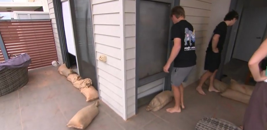
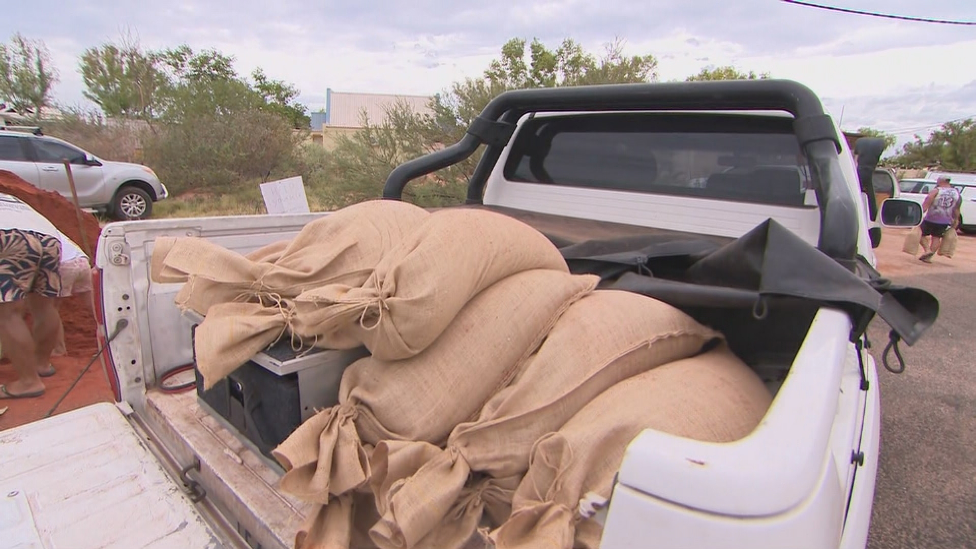
Those in Exmouth hit the shops yesterday to stockpile on supplies before doors closed at midday.
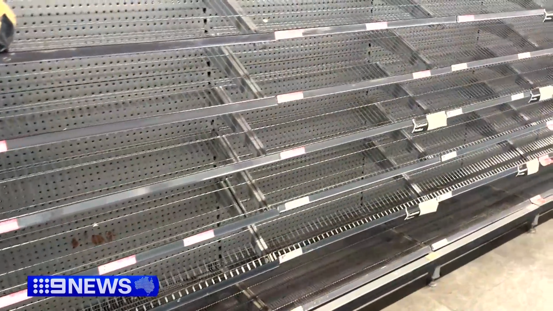
Holidaymakers and residents loaded trucks and trailers with sandbags as preparations continued across the day.
Dozens of emergency services personnel were sent to the region, with members of the Department of Fire and Emergency Services saying they're prepared for anything.
Operators closed today and cancelled bookings just a week out from the Easter holidays.
"That's just the ride that we're on, and the place that we live in up here," Dave Gillespie from Exmouth Escape Resort told 9News.
"It's one of those extra burdens that we've got to put up with."
The system's threat also forced travellers to re-think their plans.
"We're heading up to Monkey Mia – well, we were heading up to Monkey Mia," holidaymaker Ian Roscoe told 9News.
"They've informed us they've evacuated the area, they've cancelled all the bookings."
Virgin and Qantas already scrapped nearly 40 services to the north-west of the state.
WA food bowl's third hit
Carnarvon, a town of roughly 5000 people, is forecast to be hit by a slightly downgraded but still powerful category 3 storm this afternoon or in the early evening.
If hit, it will be the third natural disaster the WA food bowl will have copped this year.
Growers have contended with a heatwave, as well as Cyclone Mitchell, which decimated crops last month.
If the crops are flattened by Narelle, it will mean no bananas for 18 months. It won't impact prices at the supermarket but it will be a devastating hit to growers.
"There's plenty of bananas in Australia, our Queensland friends have got lots over there, so there'll be plenty of bananas to go around," banana grower Les Ball told 9News.
Evacuation centre concerns
Buildings in the Canarvon region are built to cyclone standard but locals are warned not to be complacent.
"The system is packing winds in excess of well over 200km/h at the moment and all those costal places between Exmouth and Shark Bay can expect those severe wind impacts," Ashley said.
Authorities are warning locals and tourists alike to take safety seriously as Narelle approaches.
"With so much uncertainty, it's critical people stay up to date with the latest information," Klemm said.
"Look around your home and ensure there's no loose objects that can become a hazard," Emergency Services Minister Paul Papalia advised.
After Carnarvon, Narelle is expected to track toward Kalbarri on Saturday, as a category 2 storm.
But the concern is there are no cyclone-rated evacuation centres between the tourist town and Geraldton.
It was a recommendation made after Cyclone Seroja smashed the region five years ago as a category 3.
"The building requirements for that area between Geraldton and Kalbarri don't require that evacuation centres, or in fact any buildings, are built to be cyclone rated," Klemm said.
Perth set for a soaking
Regardless of where and how the storm tracks, Perth is set for two days of heavy rain.
A total of more than 100mm could fall as the effects of Narelle are felt in the capital city.
Heavy rainfall and gale-force winds are forecast to start impacting the city as early as tomorrow.
Many events across Perth, including weddings, have been cancelled or postponed as the city expects a storm surge that will deliver up to 45mm today and a further 50mm on Saturday.
NEVER MISS A STORY: Get your breaking news and exclusive stories first by following us across all platforms.
- Download the 9NEWS App here via Apple and Google Play
- Make 9News your preferred source on Google by ticking this box here
- Sign up to our breaking newsletter here