A weather system building towards parts of south and south-eastern Australia is expected to bring a mixed bag of conditions.
The deep low-pressure system brewing below Western Australia is expected to bring rain, storms, strong winds, heat, and then cold temperatures to Victoria, NSW and Tasmania.
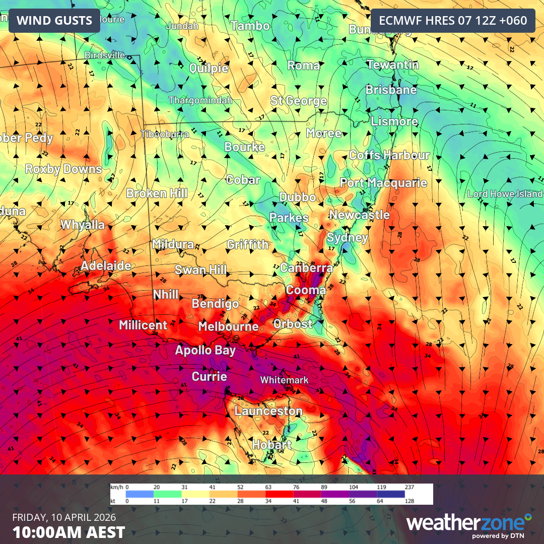
Weatherzone flagged the system on Monday, predicting it would bring wind gusts of more than 89km/h to Australia's south-east on Friday morning.
READ MORE: 'How dare you?': Some of Trump's biggest supporters turn on him
Storms and showers are expected to move in an easterly direction from South Australia tonight and into tomorrow.
Severe thunderstorms are a possibility on Thursday across South Australia's south, NSW's south and Victoria.
At the same time, temperatures are expected to rise beyond 30 degrees in some parts of Australia's east.
READ MORE: A Sydney expat was slapped with drink driving charge on a Lime Bike. So what are the rules?
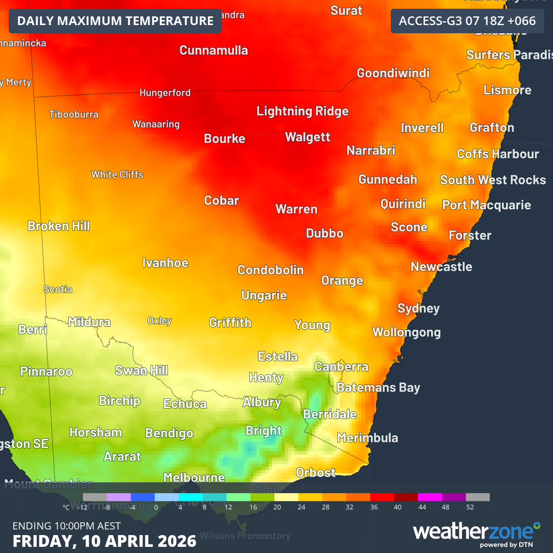
The intense heat is set to begin tomorrow in Victoria, with tops of low 30s in the state's far north-west and in NSW's west.
Sydney is expected to cop the brunt of the heat with highs of up to 34 degrees expected on Friday, nudging the state's hottest ever April day of 35.6 degrees.
Meanwhile, parts of Tasmania are being told to prepare for snowfall as low as 700 or 800 metres by Friday, with conditions expected to continue into the weekend.
NEVER MISS A STORY: Get your breaking news and exclusive stories first by following us across all platforms.
- Download the 9NEWS App here via Apple and Google Play
- Make 9News your preferred source on Google by ticking this box here
- Sign up to our breaking newsletter here